South Wellfleet’s Cedar Swamp

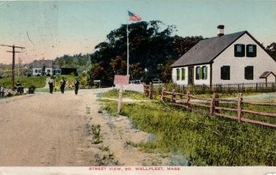
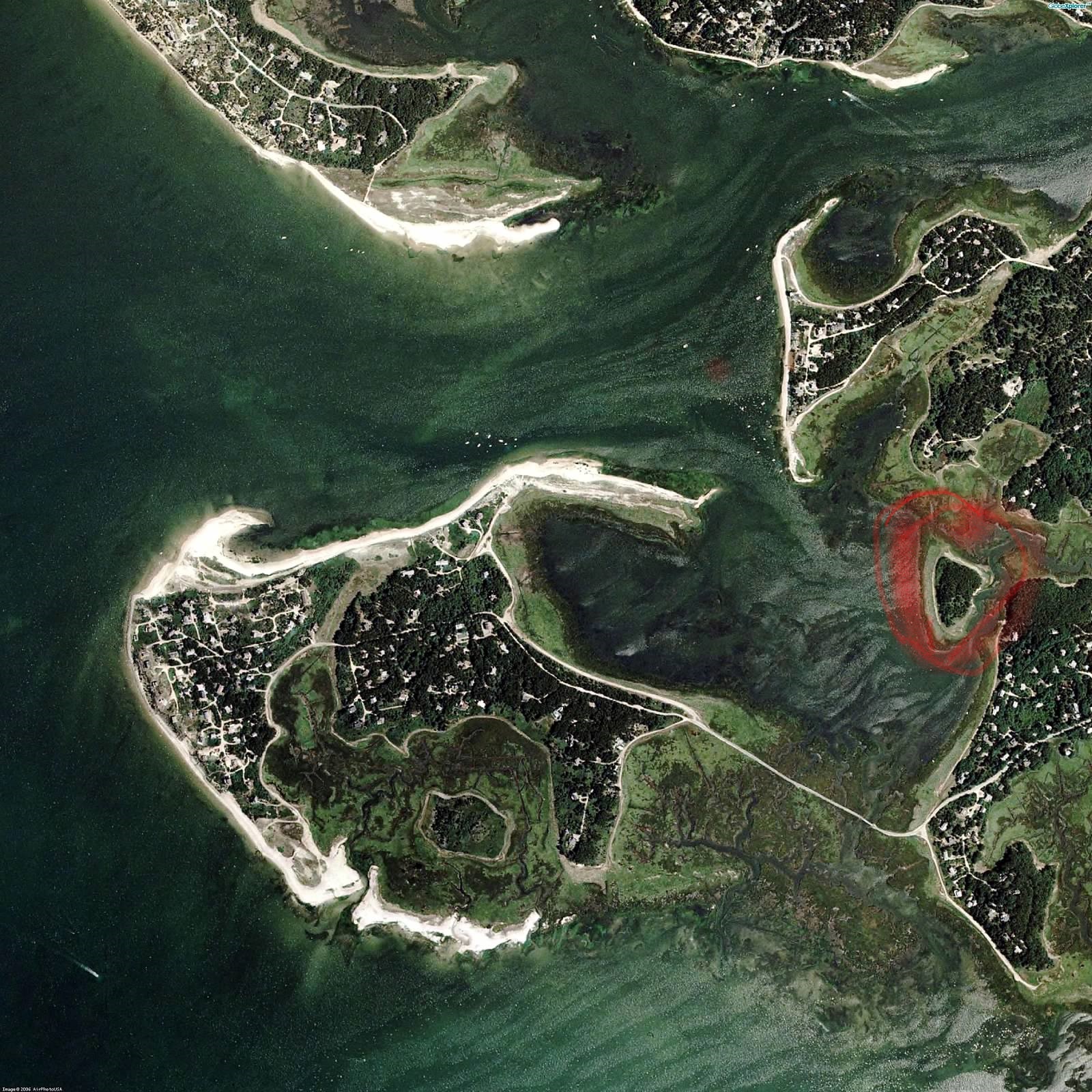
The Atlantic White Cedar Swamp (Chamaecyparis thyoides) within the Cape Cod National Seashore (CCNS) is popular with park visitors. While accessing the walk involves driving out to the parking area for Marconi Beach, the swamp and its boardwalk trail are relatively inland, not far beyond the Rail Trail as it winds through South Wellfleet. On a map, the swamp is just to the north and west of the South Wellfleet Cemetery.

The CCNS brochure describes how the cedar swamp was formed. Glaciers left a depression in the land; as the ocean rose, the freshwater table of land was lifted, and a “kettle pond” developed about 7,000 years ago. Some 5,000 years ago, Atlantic White Cedar began to grow in the depression, as it did in numerous areas around the Cape and southeastern Massachusetts. Today’s plant debris in the swamp makes a peat layer of 24 feet.

A few years ago, I heard from a neighbor that one of the National Park’s outstanding volunteers, Rusty Moore, had done some work researching the owners of the Atlantic White Cedar Swamp. Since this is a South Wellfleet landscape feature, it caught my interest. Recently, thanks to Bill Burke, the park’s Cultural Resources Program Manager and Historian, I received the materials Rusty left in a file at the Seashore offices.

As I reviewed Rusty’s materials and then did my research, I found myself following what may have been his thought process. Beyond the research on the swamp owners, which was discovered only by reading multiple deeds at the Barnstable County Registry of Deeds, there was a question: How was the cedar used as a resource?

The books and other documents typically used for Cape Cod history provide scant evidence of the use of cedar by the Cape’s settlers in the 17th, 18th, and 19th centuries. Other natural resources are fully covered: whales, fish, shellfish, salt hay, cranberries, and salt-making.

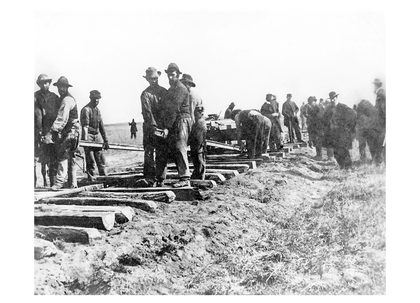
The forests that were a resource for the Cape’s settlers were decimated by the early to mid-1700s. Cedar would have been one of the resources destroyed. According to a contemporary description, growing a new tree takes up to 50 years. According to the Seashore’s brochure, the original Cape builders used cedar for their farm buildings, for joists, frames, doors, rafters, floors, and for tanks to hold whale oil. They made fence posts to mark their property and to contain their cattle and sheep. 

Wellfleet Fence photo by Pam Tice
Taylor Farm in Wellfleet Wellfleet Historical Society and Museum Photo

In his 1939 study of Cape Cod’s forests, Alpeter notes that when the Pilgrims landed, 97% of the land surface of Cape Cod was covered in forest. The principal tree species were white pine, hemlock, pitch pine, red and white oak, white ash, yellow birch, beech, red maple, tupelo, sassafras, and holly. He notes, “Great stands of coast white cedar (his term) occupied the bogs.” In 250 years, all of this forest was eliminated through systematic burning, clear-cutting, excessive pasturing, and insects and fungi attacks.

Wood was a fuel source, and it was used for home building and ship building. Initially, salt was made by boiling seawater, and the fires were made by burning wood. Wood fires also supported the try-works where whale oil was processed. Cedar might have been used in the building of salt works in the late 18th and early 19th century; a 1992 newspaper article about dredging at Rock Harbor mentioned cedar pilings “that might have been related to saltworks construction.”

Rusty’s file included neatly typed quotations from three writers in the 19th century who observed the lack of trees on the Cape. Timothy Dwight, the President of Yale College, wrote about the eastern United States in the 1790s, covering the outer Cape in 1800.  He noted that, from Orleans, there was no forest until he reached a point one mile south of Wellfleet line. From this point to Wellfleet Village was a stand “lower and leaner than any we had seen before.” Dwight was followed by Edward A Kendall who wrote about his travels in the northeastern states in 1809, covering North Eastham and South Wellfleet. Finally, Rusty included Henry David Thoreau’s writing about the lack of good-sized trees on his walk in 1849.

Altpeter also discovered that, shortly after 1706, the Reverend Samuel Osborn of Eastham began teaching local inhabitants to use peat for fuel, “proving that 65 years had been sufficient for the people of Eastham to complete the destruction of their forest.”

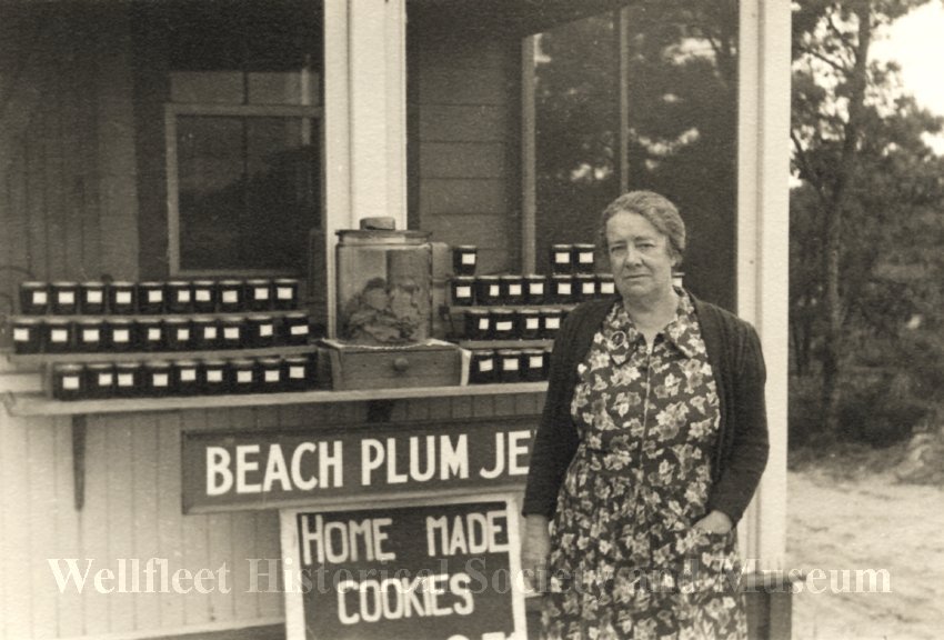
Another item in Rusty’s papers was a copy of a letter from Mary Magenau, whose home was near the South Wellfleet Cedar Swamp. Mrs. Magenau wrote to the University of Massachusetts Forestry Department concerning information she had promised them about uses of the cedar swamp, based on her review of deeds that mention the swamp. She cites references to uses of the peat in the cedar swamp as possibly to enrich garden land due to the very poor soil in Wellfleet. But might it be possible that the harvesting of peat was for fuel?

The 1839 deed transferring a portion of the swamp from Timothy Cole of Eastham to George and Timothy Ward of Wellfleet reserves Mr. Cole’s right to “get peat” in the three winter months. This may be noting a use of the peat for fuel, not for enriching soil.

A search for Atlantic White Cedar in the pages of The Barnstable Patriot in the 19th century found plenty of mentions of cedar swamps all over the Cape. Most mentions were part of land sales descriptions, and several noted the conversion of a cedar swamp into a cranberry bog, a popular habit of the time.  I found only one noting the actual use of the cedar trees.

An article in 1847 noted that Mr. Lovell of Yarmouth had covered a cedar swamp with beach sand to create a cranberry bog. 

In 1888, it was reported that three gentlemen purchased four acres of cedar swamp in West Harwich to make into cranberry land. Also in 1888, Mr. Nickerson of South Orleans engaged a force of men clearing up a cedar swamp for cranberry culture.

In 1891, Mr. Phinney of Barnstable advised farm management, recommending that farmers “ditch the swamp and drain it, and turn it into a hay crop.”

In 1892, Mr. Frank Crocker of Hyannis received six horses from Boston to be used in draining the great cedar swamp “over east.”

In 1903, in one of the few mentions of cedar’s usefulness, Centerville’s Mr. Guyer “had a gang of men in the cedar swamp last week cutting and stripping poles to be used by the new Telephone Company.”

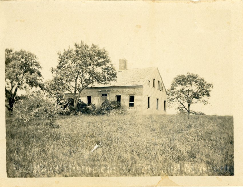
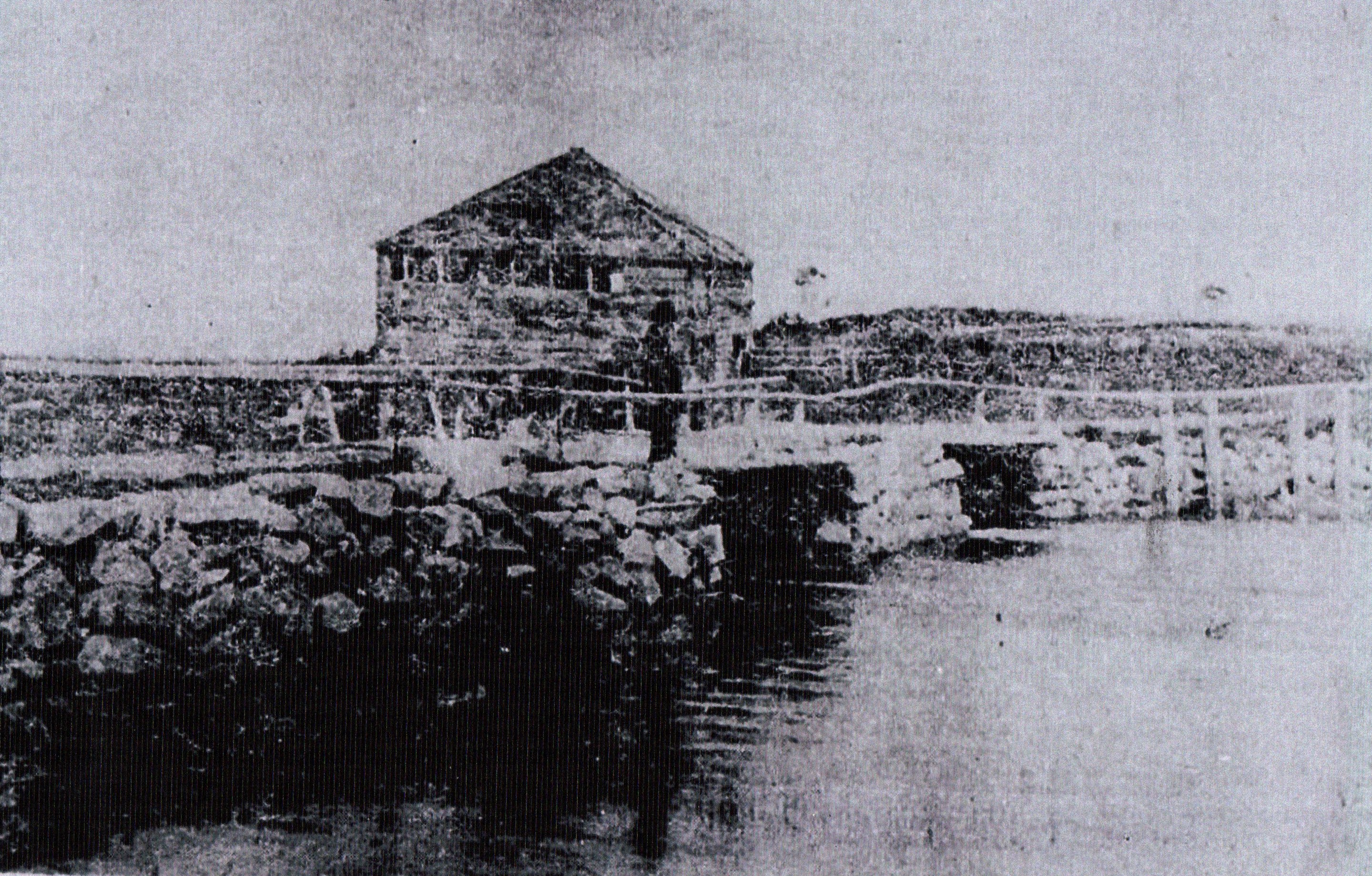
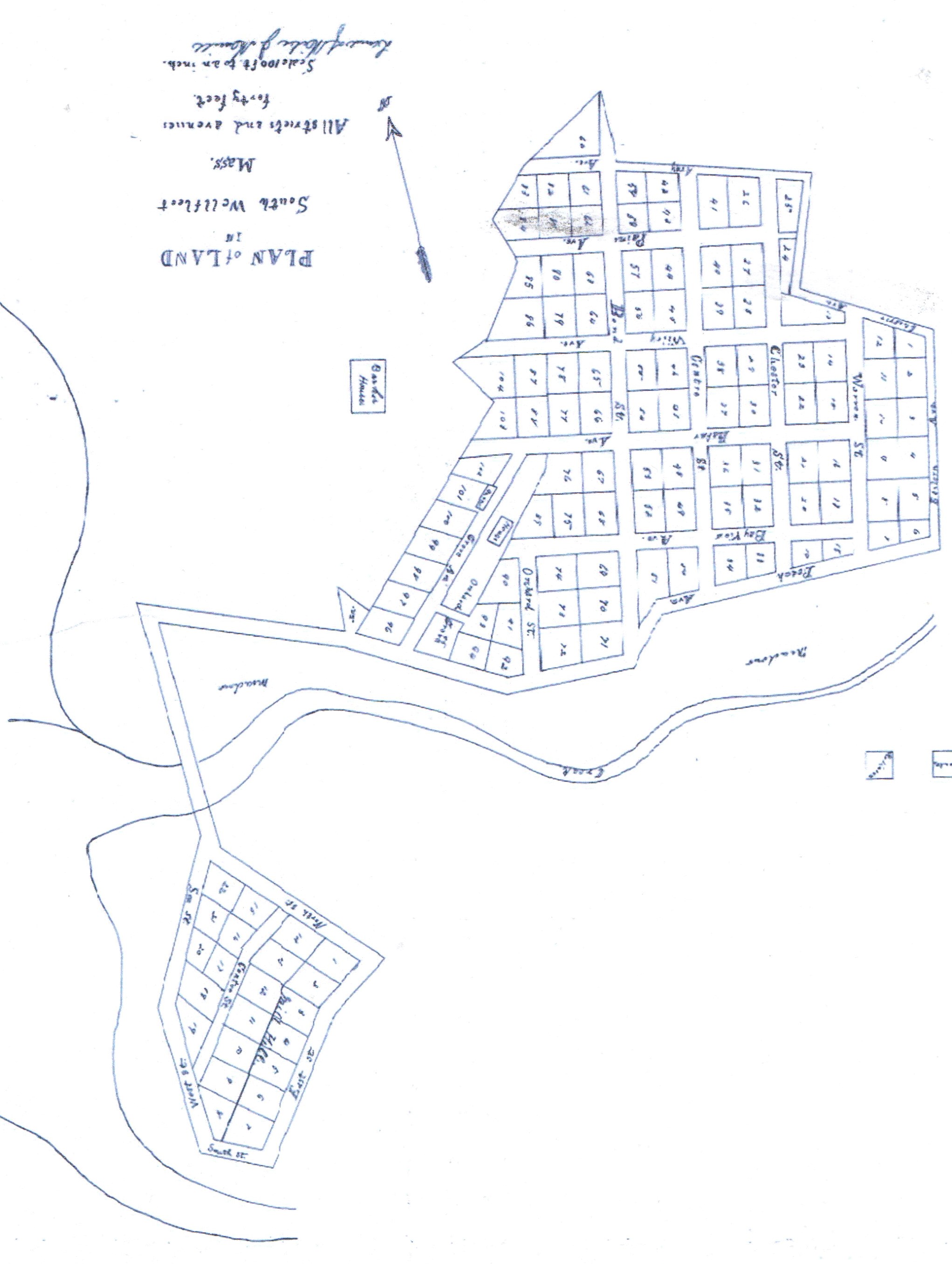
Finally, Rusty’s file included a page of a sketch of the cedar swamp land that he annotated with notes about owners. South Wellfleet neighbors shared the ownership: Timothy and George Ward, William Hatch, David Wiley, John Witherell, Noah Doane, and Ephraim Stubbs. Elbridge and Oliver Arey, sons of the second Reuben Arey, were left portions of the swamp in their father’s will. (As I worked on this project I discovered that Timothy Ward sold his home to William Hatch, which is the house that burned to the ground in 1939 that I wrote about here.)

Perhaps the number of owners helped “save” the swamp from being turned into a cranberry bog that a single owner might have pursued.

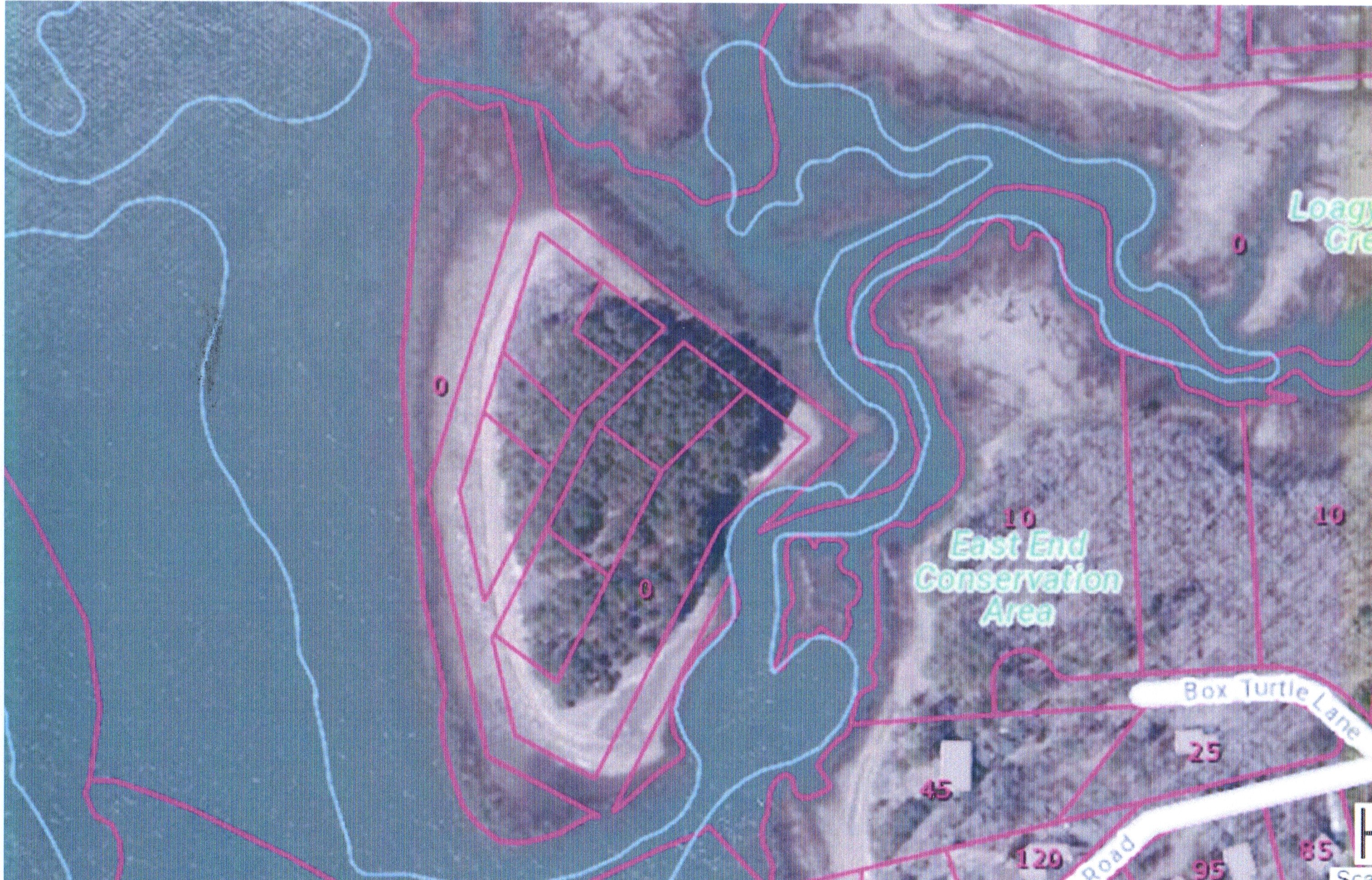
Rusty used a sketch of the swamp that was part of what appears to be a report on samples taken from the swamp. I may have identified this sheet as coming from a multi-university study of climate change. The study used samples from Atlantic White Cedar tree rings from 20 swamps to reconstruct temperatures in New England using radiocarbon measuring.

Another piece of paper in Rusty’s file was the 1850 “manufacturing census” part of the federal census, listing the men of Wellfleet who owned businesses. The first eight were carpenters, with George Ward, one of the cedar swamp owners, having the most extensive operation. While the others employed one man, he employed four and produced eight buildings yearly. This is the only link I found of an owner who may have been using the cedar.

That ended Rusty Moore’s papers and my exploration of Atlantic White Cedar in South Wellfleet.

In recent years, the Wampanoags have shared their use of cedar to build the frames of their traditional homes called wetus. My contact at the Truro Historical Society, where a wetu was recently built at the Highland House museum, thought that the source of that cedar was from Connecticut.  There’s also a wetu at the Atwood Museum in Chatham. It’s easy to imagine the cedar from South Wellfleet serving this purpose.

Wetu at the Atwood Museum Chatham Historical Society photo

Robert Finch recorded his essay about South Wellfleet’s White Cedar Swamp in his weekly “In This Place, A Cape Cod Notebook” in 2014. He found the White Cedar Swamp “magical and full of wordless meaning … a deeply mythic place, encompassing a watery underworld, a silent and muffled Middle Earth, with glimpses of a celestial overworld.”

SOURCES

This is a link to the tree-ring study: web.whoi.edu/coastal-group/wp-content/uploads/sites/38/2020/12/Pearl-2020-A-late-Holocene-subfossil-Atlantic-white-cedar-tree-ring-chronology-from-the-northeastern-United-States.pdf

Altpeter, L. Stanford “A History of the Forests of Cape Cod” un-published 1939 M.S. thesis, Harvard University, Cambridge, Massachusetts. npshistory.com/publications/caco/forest-history.pdf

Finch, Robert’s broadcast of his walk through the Atlantic White Cedar Swamp: Wellfleet’s White Cedar Swamp: A Walk Through the Brain of Nature | CAI

1850 Manufacturer Census for Wellfleet available at www.ancestry.com

Deeds for Barnstable County are available here: Barnstable County Registry of Deeds

Cape Cod National Seashore brochure “Atlantic White Cedar Swamp Trail,” undated

Posted in Uncategorized | Leave a comment

The Other Wellfleet

I only discovered the “other Wellfleet” when a Google Alert announced that a rodeo was coming to town. Wondering why Wellfleet, Massachusetts would be planning such an event, I clicked on the news, and there was Wellfleet, Nebraska. Recently, I decided to explore the other Wellfleet’s origin, the only other one in the United States far from the Massachusetts coast.

Wellfleet is in west-central Nebraska, in Lincoln County, about 250 miles west of the Missouri River. The Platte River flows through the county from west to east.

Cape Cod journalists have written about Wellfleet Nebraska. In 2006, the Cape Cod Times reporter Eric Williams told the story of Wellfleet’s founding by a “real estate man from Massachusetts” named Carroll Hawkins and a British investor named Dr. Frederick J Tompkins. The story is found in numerous places, making it the official origin story of the town.

As I began to research the story of these two men, I expected to find that Hawkins had a Cape Cod connection. However, I found a different and more complicated tale. So, while this story has nothing to do with our Cape Cod Wellfleet, I thought I would write about it here, just to offer another point of view.

Researching the origin of Wellfleet required a brush-up on U.S. History. Nebraska’s land is part of the Louisiana Purchase (1802) and Its history includes the displacement of native people. The route to the west through Nebraska’s Platte River Valley was already established. Nebraska became a territory in 1854 with the Kansas-Nebraska Act which increased the tension in the country as the white settlers were allowed to vote on whether to allow slavery. In 1867 Nebraska became a state. The Homestead Act of 1862 increased settlement, giving individual citizens 160 acres of land if they could “prove” it by building a home and farm at least ten acres for five years.

Nebraska began to be settled by Americans after Lincoln signed the Pacific Railway Act of 1862 establishing the plan to build a railroad across the country to aid settlement. The Union Pacific’s Transcontinental Railroad was completed in 1869 and other railroads, including the Burlington, built interconnecting lines to move people and their farm crops. The federal government deeded thousands of acres to the railroad companies which they, in turn, could sell off to finance their operations.

Building railroads was at the forefront of everything from finance to technology in the mid-19th Century. Civil engineers were attracted to the industry just as high-tech is an attraction today. The profession developed its procedures for surveying and construction of tracks and bridges. As the roads were laid out, it was typical to designate a town every eight miles or so, as the steam engines needed water.

Nebraska Historical Society

The railroads financed their operation by forming land companies that sold their land holdings, laid out the towns along their routes, and eventually “platted” or formalized the town by laying out the streets and blocks and defining property lines.  The land company for the Burlington was the Lincoln Townsite Committee.

In my search for links between Nebraska and the Cape, I found a small notice in The Yarmouth Register on March 12, 1880 that A. H. Knowles, a Civil Engineer from Yarmouth, was headed for Nebraska to work on the Burlington and Missouri Railroad.  A further notice was posted in June 1881 that Mrs. Knowles and their two children would join him. Knowles, the son of a sea captain, was pursuing a popular career choice. I matched Mr. Knowles’ stay in Nebraska with the fact that the Burlington Railroad was built through Lincoln County in 1880-1881, establishing stations in Ingham, Wellfleet, Somerset, Dickens, and Wallace.  The Lincoln Townsite Committee platted the towns of Wellfleet and Wallace in 1887 and Dickens in 1889.

It was not possible to determine if Mr. Knowles or his wife bestowed the name “Wellfleet” on the Nebraska town. I looked for some connection between the Knowles family in Yarmouth to Wellfleet but did not find a certain match.

The Barnstable Patriot reported in September of 1881 that Mr. and Mrs. Knowles had returned to Yarmouth where they made their home for the remainder of their lives.

Mr. Knowles was not the only Cape Codder I found working in Nebraska. Thomas Doane of Orleans went to Nebraska in 1869 to work on the Burlington after making his reputation in New England as the chief engineer of the Hoosac tunnel project in western Massachusetts. Mr. Doane settled in Crete, building a large mansion, and convincing Burlington to donate land to establish a college, today’s Doane University.

 Another engineer, Anselmo Smith, a civil engineer on the Chicago, Burlington, and Quincy Railroad named a town “Hyannis” in 1887, out in the sand hills of northwestern Nebraska. The Cape Cod Hyannis has regular news reports of people visiting the Nebraska town. In 1872, another engineer bestowed the name “Orleans” on a town in Harlan County.

With Wellfleet established, the newspapers began to cover the life of the town.  In November 1885 the railroad company erected a fine station building and a section house. There was a lumber yard in the town. Nearby Medicine Creek reportedly produced a fine flow of water. The report goes on to cover the status of Somerset, Dickens, and Wallace. 

In late 1887 the newspapers reported that the railroad was putting down a well in Wellfleet, and, in February 1888, building a water tower. There seemed to be some confusion in November 1887 whether the post office was open or not. Mr. A.L. Davis who owned a store there was working on building a boarding house. Mr. Davis would also provide a Christmas tree for the young people in Dec 1887. In February 1888 there was a report that a saloon would open, and, by March a complaint that the saloon was not properly licensed and that there should be a church instead. In June it was reported that Wellfleet was too small to have a Fourth of July celebration, so everyone would be in Wallace or Curtis instead. Two schoolhouses were covering the district. Farmers were “proving” their homesteads.

This is when Wellfleet’s other origin story begins. The story credits Carroll Hawkins and Dr. Frederick James Tompkins as either “founding” or “building” the town, although the town already existed. Hawkins is characterized as a “Massachusetts Real Estate Man” and Tomkins as a British barrister. It was popular for British capitalists to invest in the western United States during the land boom of the late 1870s and 1880s.

Carroll Hawkins was the son of an Episcopal minister, W.G. Hawkins. Born in Massachusetts in 1863, Hawkins came to Nebraska when he was 15 years old when his father was sent to Beatrice, Nebraska to be the Episcopal minister there. Hawkins first appeared in the newspaper in 1885 when his job as Deputy Clerk of the District Court in North Platte ended as the office did not have enough work to support his position. By 1886 he was elected as County Clerk. In the 1885 state census, he is in North Platte living in a hotel where he worked as the night clerk. North Platte is about 30 miles north of Wellfleet and the county seat for Lincoln County where Wellfleet is located.

There was no evidence gleaned from the local newspapers that Hawkins was “a real estate man from Massachusetts.” A historian from NE recently commented that perhaps he had become one later in life, and, indeed, in his obituary in 1941, Hawkins was a prominent citizen of Paonia, Colorado, a man with a real estate and insurance agency who had served his community for many years.  

Dr. Frederick James Tompkins was described in the newspapers as an eminent barrister from England. His obituary in 1904 when he was 90 years old described his career beginning as a Congregationalist minister who was sent to Nova Scotia in 1847 where he organized and built Gorham Congregational College in 1855. In 1859, Tompkins returned to England and studied law. He was admitted to the bar at Lincoln’s Inn. During the Civil War in the United States, he was a war correspondent for the London Times and other British publications, reporting from General Grant’s headquarters. No mention was made in the obituary of his involvement in Nebraska.

In the spring of 1888, Dr. Tompkins was invited to give the commencement speech at the University of Nebraska in Lincoln. He was described as “one of the foremost barristers” of his country. He was in the U.S. attending an international law conference. There was no information found on what attracted him to Nebraska. Perhaps Tompkins envisioned himself as a British capitalist. in that role. Later, in October of 1888, Tompkins came to the state, visiting Lincoln where the state bar association asked him to speak. WE do not know if he was a friend of the Hawkins family before that time, or if they met in Lincoln.

The following year, In May, 1889, the local newspapers reported the founding of the Wellfleet Real Estate and Improvement Company, incorporated with the Secretary of State with a capital stock of $1 million, offering 10,000 shares at $100 each. Described as a powerful syndicate, the company was headed by Frederick James Tompkins. The Vice President was Reverend W.G. Hawkins, and the Secretary was Carroll Hawkins. The directors were from Halifax, Nova Scotia, and London, England. Another Hawkins son, Joseph, was on the board also. In this report Tompkins was credited with helping Birmingham, Alabama, get started on the road to prosperity with British capital, although my research showed no connection. Tompkins was described as a barrister at law for all the large steamship lines in England, a member of the historical society in New York, and a member of a council that sought to codify the laws of all nations. There is a kind of “hucksterism” around the reporting, making Tompkins a professional man of the highest order.

It was reported that the Reverend Hawkins and Tompkins had traveled around England together for the previous four months, giving lectures about Nebraska, and seeking to establish a colony of 100 Englishmen in Wellfleet. This fact appears to put the Hawkins-Tompkins connection between Carroll Hawkins’s father and the barrister.

The Wellfleet Real Estate and Improvement Company purchased twelve hundred acres in Wellfleet, announcing that they would build a townsite. True, other entities could build towns. But Wellfleet already existed. Their most significant project of the company was to be a beet sugar factory, but they also planned to build a hotel, and perhaps a flouring mill, a canning factory, a creamery, and a cheese factory.

In 1889 a beet sugar factory was in development at Grand Island, Nebraska, 150 miles to the east on the Platte River. Beet sugar was developed in the mid-19th century as an alternative to the more expensive cane sugar. The factory opened in 1890 and was a success, with a second factory in Norfolk, Nebraska. There were numerous reports in the fall of 1889 of laboratory tests of sugar beets grown near Wellfleet as perfect for production at a factory.

Cheerful stories of the promise of Wellfleet continued through 1890 and 1891. However, there were contradictory stories too. In November 1889, while plans were underway for a dance in Wellfleet to raise funds for an Episcopal church building, there was another story in the Omaha papers about a young Englishwoman of some means, a portrait painter, who had given Dr. Tompkins a check from her brother that Tompkins was supposed to cash for her and give her the money. He did not. Further, the story continues, his associates in Wellfleet may have lost confidence in him.

In the winter of 1890, it was announced that the new head of the Wellfleet Improvement Company was George H. Edbroeke of New York City. Mr. Edbroeke was a prominent architect who had developed several buildings in Chicago and had relocated to New York. During that winter, Carroll Hawkins traveled to New York City to meet with the new president and review the plans for the beet sugar factory. In the summer of 1890, Mr. Samuel Chafen of London came to Wellfleet to help develop both the hotel, the factory, and the dam that was needed to provide the water power for the factory. Later, in the fall of 1890, Tompkins himself wrote a newspaper piece about how he was wrongly accused of this slander, and that the unnamed person who reported it added his name by mistake.

To bring the story to an end, none of the projects promised by the Wellfleet Company came to fruition. Further, there was a drought in 1891 that affected Wellfleet. In July 1891, the partially built hotel in Wellfleet was brought down by a cyclone, the term used then for a tornado. A newspaper story in 1892 called Wellfleet a “sad exhibit of a busted boom.”

Of interest to Wellfleet, Massachusetts, is a report of the efforts of a Nebraska man named F.H. Crowell who lived in Beatrice. He was in touch with a church in Wellfleet, Mass, and had barrels of donated clothing and other goods sent to Nebraska for the “western sufferers.” Perhaps he had a connection with the Wellfleet Crowells, although his family was in Boston. 

Wellfleet in 1917 Nebraska Historical Society

Wellfleet continued. In 1908, a bank opened. In 1932, a dam was built creating a lake for flood control and recreation. The population dropped in the 1940s when many people found war-related jobs elsewhere. The high school and the bank were closed. When a highway to North Platte was paved in the 1950s, shopping moved to the larger town and businesses closed. The railroad discontinued passenger service in 1950 and closed the depot in 1958.

In 1987, The Barnstable Patriot reported that a group from Cape Cod Wellfleet visited Nebraska Wellfleet to help celebrate the town’s 100th anniversary. Eric Williams also reported this event in his 2006 article; the visitors included a former Wellfleet Massachusetts selectman.

While the population is only 75 now, the September rodeo continues every year to celebrate the community, with horse races right down the main street.

Wellfleet today

Sources

Newspaper sources www.newspapers.com

Ancestry.com for family connections

The databases of The Barnstable Patriot and The Yarmouth Register are now at www.smalltownpapers.com

Nebraska State Historical Society “Railroad Development in Nebraska 1862-1980, A Historic Context,” June 2014. Downloaded August 2024.

Maywood Public Schools – Wellfleet, Nebraska (maywoodtigers.org)

1482 (arcgis.com)

Posted in Uncategorized | Leave a comment

The Most Famous South Wellfleet Photograph

If you are upset by killing animals please don’t read this.

This image may be the most widely distributed photograph of South Wellfleet.  It was taken by Provincetown photographer George Henry Nickerson (1829-1902) in November 1884 when a large school of blackfish was herded ashore in South Wellfleet.

Today we may experience a “blackfish stranding” when these pilot whales land on one of our beaches and breathe their last. But in 1884, the value of the oil in both the blubber and the “melon” in the blackfish’s head made these creatures profitable. Thus, when a school was glimpsed in Cape Cod Bay, all the local men jumped in their boats and tried to capture them. Cape Codders have many tales of such incidents happening, even on a Sunday morning while a church service was underway.

In a 1992 article in The Cape Codder, Eastham historian Noel Beyle wrote about the photograph and Mr. Nickerson. Mr. Nickerson was a Civil War veteran with photography studios in Chatham, Orleans, and Provincetown in the mid-19th century.  Beyle spoke with Gordon D. Spence of Wellfleet about the location of the photograph, on the beach near Old Wharf Point on Loagy Bay.

Spence commented that the beach here was often called “Barkers.” The Barker family lived nearby and there were no houses at the top of the dune as there are today. Isaiah Barker was a cooper (barrel maker) which fits in with the job of moving mackerel catches from the wharf to the South Wellfleet railroad station. As mentioned below, Mr. Barker took part in the blackfish catch that day. He died in 1885 at 77 years old but must have been out and about on the day of such an exciting event so close to his home.

The Boston Globe wrote about the 1884 event on Tuesday, November 18, 1884. The adventure started in Provincetown on Saturday afternoon, November 15, at about 3 pm when the cry went out about the blackfish in the bay. A large group of men tried to drive them closer to shore to kill them but they came too close to the fish weirs, and it began to get dark, so they returned to shore with only a few captured.

The next day, Sunday, in the early morning, more men in boats found the school again and it was driven across the bay to Dennis and Brewster “but efforts to drive them to shoal water were of no avail.” They killed as many as they could with “case knives” and succeeded in capturing about sixty. The story goes on to report that the remaining blackfish “found deep water” and were chased across the bay assisted by several mackerel fishermen who joined in the pursuit.

The Globe did not mention whether the men stayed in the bay all night. It states that early the next morning (Monday) the fish were driven into Wellfleet Harbor with 150 driven ashore at Indian Neck and immediately killed by the boatmen assisted by many inhabitants on the shore. Now the remaining blackfish in the bay were unable to escape the harbor. The men succeeded in driving 1300 of the “sea monsters” ashore at Blackfish Creek.

The writer goes on, “Thus ended at dark last night the most exciting chase ever witnessed in these waters. The fish were attracted by the large quantities of squid and herring on which they feed. They are very valuable for the fine oil they make for watches and other delicate machinery.” This report valued the catch at $25,000 which would be divided among 500 participants of Provincetown, Truro, and Wellfleet who took part in the capture.

The article ends with a comment that a large number were purchased by Cook and Company of Provincetown and would be tried out at Cape Cod Oil Works at Long Point.

The Boston Globe’s description of the event was covered in many newspapers across the county in the two weeks following the event. A few newspapers added gory details to the description of the event. A paper in Indianapolis described how “vessels and boats of all kinds with men and boys of every trade and practice” went out on the bay on Monday. “Men of experience used harpoons and lances to make the kill and others used scythes, knives, daggers, picks, and axes.” A Maine newspaper stated, “Everyone big enough to handle a weapon was killing a blackfish.”

The writers added how the shore was lined with carriages and carts as men, women, and children came out to witness the event. All business was suspended. “Free use was made of the railroad which brought many from miles away to witness the excitement.” That report estimated the number of blackfish to be 1200 to 1500 to be divided into 500 shares, the value probably between $10-15,000. The fish are to be sold at an auction tomorrow.”

Later newspaper reports give a few details as to how the individuals involved in the event would benefit. On November 29, 1884 The Barnstable Patriot reported that the blackfish taken on the Cape recently were sold at auction to the following:

William Nickerson of Eastham, 24

Henry Cook of Provincetown: 512 and 24 porpoises

Harvey Cook of Provincetown: 200

S.S. Swift: 300

Isaiah Barker: 72 porpoises

American Oil of Wellfleet: 447

The article ended by noting there were 1498 blackfish (my addition comes to 1483) and 96 porpoises and that 400 to 500 claims had been filed.

(A quick check on how porpoises were used and it appears to be the oil in the blubber since eating them was not as popular as it once had been.)

The next article about the financial rewards from the event was found in The Yarmouth Register of December 6, 1884 reporting on a meeting of The Blackfish Company held in Union Hall with Captain Warren Newcomb moderating. Mr. Newcomb was a grocer in Wellfleet. The total amount to be realized from the sale was $15,353.75. “Everyone over 15 years should draw a full share; keelboats and dories a share, and those under 12 years a quarter share. A committee was named to settle the shares. The Treasurer’s Book had an accounting taken of “the time each man was employed.” No record was found of the company in Wellfleet as to whether it was an ongoing concern to handle the distribution of blackfish funds or established just for this event.

Image from the Wellfleet Historical Society and Museum

A later article on December 20, 1884, in The Yarmouth Register noted that at a meeting of The Blackfish Company” on December 10 decided to pay a dividend of $24 a share payable at Mr. William Tubman’s place of business.  The 1880 federal census lists Mr. Tubman as a blacksmith. The same paper reported in a separate piece on that date that American Oil of Wellfleet has sold and shipped 1000 barrels of blackfish oil in the past week. “The works are being run day and night as there is a large quantity of blubber still on hand.” On December 30, 1884 in their Wellfleet column, The Barnstable Patriot reported that the American Oil Company finished trying their oil on Saturday having gotten about 400 barrels.”

On January 13, 1885, George H. Nickerson announced in The Barnstable Patriot that he had six excellent views of the recent school of blackfish captured at Wellfleet and would send an image to any address on receipt of $1.50.

This stereopticon view may be one of those views:

Noel Beyle wrote in his 1992 article that Irving L. Rosenthal went into business with Mr. Nickerson and continued the studio after Nickerson died in 1902. Nickerson’s “Cape Cod Views” were highly collectible. The tourism industry on the Cape developed as the century turned. Postcards became very popular. The 1883 photograph was sold, first as a black and white image, and later a colorized image.

Mentioning the value of the blackfish catch on the postcard gave the event an added element of excitement, sharing with visitors the high value of the dead animals who landed on the beach. The $15,000 of 1884 would be worth nearly a half-million dollars today.

While not taken on that day, this image of a blackfish event at a later date gives another view of the slaughter that happened on our beaches.

Sources

www.newspapers.com

photos from Massachusetts Digital Commonwealth

The Barnstable Patriot at the Sturgis Library (the database not available for a few months while it transitions to a new platform)

Posted in Uncategorized | 2 Comments

Hinckley’s Corner in South Wellfleet

Postcard from the archived photo collection at the Wellfleet Historical Society and Museum

In December 1931, the Hyannis Patriot newspaper covered the birthday of South Wellfleet resident Mrs. Mary Newcomb who was celebrating her 85th birthday. Although she had a bit of rheumatism, the reporter found her cheerful and engaged with an interest in current events as she listened to her radio.

Mrs. Newcomb was born Mary Hinckley, and her home was the house that still stands today at South Wellfleet’s Hinckley’s Corner. In 1931, it was located on the “State Road” (Route 6). Today that road is named “Way 112” a byway to Route 6. The houseand the cornerare where Way 112, Paine Hollow Road, and Drummer Cove Road converge.

The Hinckley Family

Mrs. Newcomb had her family genealogy handy on the day the reporter interviewed her, perhaps reflecting the veneration of Colonial times in her day. She began with her first-generation ancestor in Plymouth Colony, Thomas Hinckley, who came to Plymouth in 1635 with his parents and went on to become a leading citizen, serving as the Colony’s last governor from 1680 to 1692. The Hinckley family followed their pastor, Reverend John Lothrop, who had come to the Colony from England to practice his religious freedom. He settled his congregation first in Scituate and later in the newly established Barnstable village.

Thomas Jr. made his family life there, marrying twice and leaving seventeen children. He played an important role as Governor in keeping Plymouth Colony as part of Massachusetts Bay Colony instead of part of New York. The 1691 Charter signed with King William and Queen Mary, created three counties, Plymouth, Bristol, and Barnstable. from the old Plymouth Colony.

Thomas Hinckley’s rather brutal time is reflected in an old record of his role as a judge in a case involving a burglary committed by a Native American who was then enslaved as a punishment. Hinckley is buried in the old Lothrop Hill Burying Ground in Barnstable.

The Hinckley family spread out over Cape Cod, and we can still see their name today as place names, business names, and the names of old houses. Fifth general Moses Hinckley, born in 1772 in Falmouth, came to Wellfleet and married Mary Chipman. In 1790, he was recorded in the first federal census in Wellfleet where he served a term as Selectman. A record of his family is in the hand-written Wellfleet birth records of that period where his daughters Mary, Nabby, Martha, Betsey, and Lavinia are recorded along with his sons Sylvester, Chipman, and Moses. Moses Hinckley is buried in Duck Creek Cemetery in Wellfleet. Sylvester, born in 1816, was Mrs. Newcomb’s father. 

The Hinckley family lived upstanding lives, participating in the life of the town. Mrs. Newcomb told of her father’s teaching at the Pond Hill School when she was a child, during the winter months, and then earning a living by fishing the rest of the year. Sylvester served as the Town Auditor for many years.  When he was 89 years old in 1905, The Boston Globe printed an article about Sylvester’s delicious Wellfleet-grown vegetables, coaxing his crop from the sandy Cape soil.

Mary Hinckley married Cornelius Newcomb in 1866 and, in 1871, had their only child, Herbert Newcomb.

Mary’s brothers, Moses and Sylvester, both left the Cape to pursue work as so many young men did in the latter years of the nineteenth century as the fishing from Wellfleet diminished. Both died rather young, Sylvester of suicide in May 1895, and Moses a few months later. Sylvester left a wife, Annie, and a child, Grace Hinckley.

Hinckley’s Corner

The Wellfleet Historical Society and Museum has a copy of the postcard labeled “Hinckley’s Corner” which was produced during the Golden Age of Postcards (1895-1915) when many Wellfleet locations were captured. This card is posted at the beginning of this post.

There is another postcard of Hinckley’s Corner that was only labeled “Street View South Wellfleet.

Using the Wellfleet Assessor’s Map I was able to follow the trajectory of the camera’s lens to identify the house on the right as the Hinckley family’s and the one in the distance as the Robert Paine house further up the hill. In her 1982 book Wellfleet Remembered (Volume Two), Ruth Rickmers used the same image but called the house on the right the “Cornelius Newcomb” home. By the time she produced her fourth volume of Wellfleet Remembered in 1984, Rickmers had a wonderful photograph by Gordon Spence of Hinckley’s corner with the house, the store and its Jenny gas, and several automobiles of that time. I don’t have permission to reproduce that photo here but the Rickmers books are the Wellfleet Library.

Color version of “Street View” postcard

Hinckley’s Corner and the Hinckley house appear to have had their heyday in the 1920s and 1930s. Cornelius and Mary’s son, Herbert Newcomb, left the Cape and had a grocery store in Brockton, Massachusetts.

In the 1920s, as more summer residents came to Wellfleet, Herbert established a food store and a gas station next to his parents’ house. One newspaper account attributed three businesses to Herbert: Newcomb ‘s Food Shop, The Economy Wood Company, and The Tourist Chambers.  The Hinckley/Newcomb house had become what we would call a “Bed and Breakfast” today.  There are many mentions of The Tourist Chambers in the South Wellfleet column of the Hyannis Patriot and Barnstable Patriot naming their many guests. Annie Hinckley, Sylvester’s widow, and her daughter Grace Hinckley Austin and her four children were frequent summer visitors.

In one of his memory pieces in The Cape Codder, called “Only Yesterday,” Holman Spence remembers:

A grocer opened a store at “Hinckley’s Corner” across the street from the intersection of the King’s Highway and Paine Hollow Road. The store was called “The Palace of Sweets,” and Herbie Newcomb started it. Herbie was quite a man in the grocery business having been in it all his life in Brockton. His was an orderly place that only sold groceries and simple household goods.  … He sold ice cream cones he called “five cent” or “ten cent” horns, fresh fruit, and vegetables. Jenny gasoline; kept the milk out of the sun in a cooler, and provided loafing space on the front veranda for the locals to gather upon.

At Herbie’s we kept up with old South Wellfleet friends and made a number of new ones. My oldest brother worked for Herbie driving his Model-T Ford delivery truck out across the dunes where “Wellfleet By the Sea” finally took hold and sprouted a few cottages. Herbie Newcomb was a restless sort and soon sold out to a man named Parker who, in turn, sold to people named Baumgarten. Next, he (e.g., Herbie) appeared in the center of Wellfleet in a new store called “The Trading Post” where the lawn in front of the Town Hall is now. This establishment continued until almost the second war and both my sister Marjorie and my wife worked for Herbie for a couple of years. Later it was converted to a clothing store on the second site.

(Herbert Newcomb’s Trading Post should not be confused with “Newcomb’s Soda Shop” on Main Street, owned by Cecil Newcomb.)

When Herbert Newcomb sold his South Wellfleet business to Baumgarten in 1932, it was reported that he was returning to his business in Brockton. However, once the Trading Post was established on Main Street in Wellfleet by 1936, he appears to have become a full-time Wellfleet citizen. 

Hinckley’s Corner Today

Today, the term “Hinckley’s Corner” is rarely used. However, it’s commemorated in a 1998 listing on the National Register of Historic Places. The cover sheet to the application notes that “Hinckley’s Corner Historic District” is the preferred name, with “Paine Hollow North Historic District” as a secondary name. Three properties are in this District, numbers 0 (now 85), 25, and 40 Way 112. The Hinckley House and its outbuildings are number 40.

Here, the Hickley House, built in 1790, is called by the name of its original owner and builder, Jonathan Young. Mr. Young (1720-1799) inherited his land in the Paine Hollow area. The Wellfleet researchers from the 1980s indicate that he probably served on Wellfleet’s Committee of Correspondence, Inspection and Safety. He served as Town Clerk in 1781. His grave is in the South Wellfleet Cemetery.

In 1804, the Young children sold their father’s house to Moses Hinckley, identified in the deed as a carpenter.

In the National Register form, and the Massachusetts Historical Society’s “Form B” related to the Young/Hinckley House, the 1804 buyer is identified as “two brothers from up Cape,” Moses and Sylvester. However, the deed shows the only buyer to be Moses Hinckley who was the father of the two. He was probably glad to find a house in Wellfleet for his growing family. In the 1804 deed, there is a dwelling house, a barn, and land, and a “cartway” mentioned. In an 1856 newspaper account, the Hinckley House is mentioned in a description of how the new County Road should be laid out.

A 1932 description of the house in the Yarmouth Register praised its attractiveness, noting that the fireplace that was once blocked up had been re-opened. It had a parlor, a dining room, and one bedroom downstairs, with a kitchen and an ell at the back. The 1981 “Form B” noted that there is a sample of its wallpaper at the Wellfleet Historical Society and Museum. The house had an organ that entertained the neighborhood young people who would gather there to sing. Mrs. Newcomb and her husband were married there.

The Young/Hinckley/Newcomb house at Hinckley’s corner is somewhat hidden from view with trees and shrubs providing protective covering. It’s more visible during the winter season when the trees are bare. The best photos are those in the National Register of Historic Places Form 10-90, linked below. You can scroll through the form to view the photos.

National Archives NextGen Catalog

Sources

Thomas Hinckley – Wikipedia and publication: Five: “New England in Old England” 1681–1691 – Colonial Society of Massachusetts

Wellfleet Historical Society and Museum photo archive

Hinckley’s Corner, South Wellfleet, Mass. – W0900 | Wellfleet Historical Society (pastperfectonline.com)

Postcard of “Street View, South Wellfleet” in a private collection and a color version online at

Massachusetts Historical Commission Form B for 40 Way 112 (WLF )

National Register of Historic Placess catalog of forms online

The Barnstable Patriot online at the Sturgis Library

The Cape Codder, online at the Snow Library

Hinckley family genealogy at Ancestry.com

Wellfleet’s Assessor’s Database

Deeds at the Barnstable County Deed database

Rickmers, Ruth  Wellfleet Remembered, Volumes 2 and 4   Wellfleet, Mass., Blue Butterfly Publications, 1982 and 1984

Posted in Uncategorized | 1 Comment

The Weird Old House, South Wellfleet

Recently, a friend asked if I could identify the South Wellfleet house pictured in this early 20th century postcard.

The postcard was printed in Germany by Leighton and Valentine Company, New York City. This company was formed in 1909 when the Valentine Company of New York and Boston merged with the Hugh C. Leighton Company of Portland, Maine.

Using the photo archive at the Wellfleet Historical Society and Museum, I identified the “weird old house” as the David Wiley house (photo W2032), based on a comparison of the window placement and the tree growing in the front. A lucky find, helped by a useful digital collection.  

Thanks to my friend’s question, and the photo match, we now know that the old house was photographed in 1905 when it was still on the south side of Blackfish Creek near Old Wharf Road. According to the Historical Society’s record of the photograph, Abbot Paine took it apart and re-assembled it after that. The photograph was taken by Clem Baker who has only one other photo in the collection. The identification was by David Ernst, former Wellfleet Selectman and a major supporter of Wellfleet’s conservation projects, sadly no longer with us.

Turns out, I had written about this house and the Wiley family back in 2013.  Based on more than one source, my post on the Wiley family identified a house moved in 1866 across Blackfish Creek and now located at 165 Paine Hollow Road.

When I wrote that post in 2013, it was before the Wellfleet Historical Society developed its photo archive. Now I know there is a second Wiley house that Abbott Paine moved in the 20th century.

I contacted my friend Irene Paine who has written about the Paine family, remembering that her grandfather was Abbott Paine. Indeed, she knew all about his project, carried out after he returned from military service in World War One. She knows that he added the dormer windows fairly soon after moving the home and made other additions later.

The house that was moved in the 1920s is now at 60 Pleasant Point Road. So many changes have been made, if it was once the Wiley house, you can’t identify it now.  It’s also possible that Mr. Paine moved another old house, or that the Historical Society’s identification is wrong.  Possibly, the house that was moved in 1866 was not a Wiley house —- the most recent Massachusetts Historical Commission’s Form B, updated recently by Lynn Smiledge, does not identify it as such.

We’re leaving this topic as a bit of a mystery.

Sources

Wellfleet Historical Society and Museum photo archive

The David Wiley place. – W2032 | Wellfleet Historical Society (pastperfectonline.com)

Massachusetts Historical Commission Form B for 165 Paine Hollow Road (WLF 335)

The Wiley Homestead in South Wellfleet | South Wellfleet, Massachusetts (south-wellfleet.com)

The Hugh C. Leighton Co., Manufacturers — Dumbarton Oaks (doaks.org)

Posted in Uncategorized | 4 Comments

The Boston Tea Party and Wellfleet History

With the 250th anniversary (the Sestercentennial) of the Boston Tea Party coming up on December 16th, I thought I’d celebrate it by sharing the story of the Wellfleet connection to the event. This is not about South Wellfleet history.  Stories about this event have recently appeared in the Provincetown Independent and the Journal of the Cape Cod Genealogical Society.

It’s only recently that I learned the tale of John Greenough and the tea that he rescued from a shipwreck off Peaked Hills Bars. In early December 1773, the brig William was on its way to Boston with the other three tea ships but got caught in a storm and went ashore. The 19th Century Cape Cod historians mention Mr. Greenough but seem to frame his venture as that of a naïve schoolmaster who thought he’d make a little money with his “side hustle” but got in trouble with his neighbors over selling the tea which had become a symbol of America’s growing fight over unfair taxation. Recent research presented a far more complicated series of events on the outer Cape.

Contemporary historians have researched the sinking of the brig William and Greenough’s role in the aftermath of the wreck in much more detail. Mary Beth Norton, a historian at Cornell University, wrote an article (and later, a book) on the topic that I recently discovered.  Professor Norton relied upon the work of other historians, newspaper accounts, and the Greenough papers at the Massachusetts Historical Society. Using newspaper databases, I read contemporary accounts of the growing ill will about the British Parliament’s tax policy. Considering his actions, one wonders if Mr. Greenough was aware of the sense of his fellow citizens. Did he have access to the Boston papers?

Before we get to the story of the shipwreck, Norton makes sure we understand how important the tea was to Americans. She described it as having an addictive quality. It was not only popular, it was part of the culture, as upper-class women took pride in their tea service and socializing over tea parties. The best tea was shipped from China by the East India Tea Company (EIC), a monopoly established by the British government, and the tea that was taxed. However, there was an active market for smuggled tea, commonly called Dutch tea.

In 1767 the Townshend Duties were enacted by Parliament. These custom duties on tea and other commodities caused the Americans to boycott products, so Parliament retreated somewhat in 1770 but kept the duty on tea. Philadelphia and New York kept up their active boycott of EIC tea, but Boston had returned to drinking it and paying the duty. However, in May of 1773, in an effort to rescue the EIC from financial disaster, Parliament imposed an additional tax on the tea. Americans interpreted this act as Parliament’s seeking to establish its authority over the British colonies. In the fall of 1773, seven ships were launched from England with tea shipments: one each for Charleston, Philadelphia and New York, and four to Boston.

John Greenough of Wellfleet was the son of Thomas and Martha Greenough of Boston. Born in 1742, he was educated at Yale and also received a Masters degree from Harvard in 1763. He married Mehitable Dillingham of Harwich in 1766 and settled in Wellfleet in 1768 when he was hired as the schoolmaster of the grammar school. In Massachusetts, grammar schools taught Greek and Latin, to prepare students for college and careers in the ministry, the law, and medicine. Greenough also became a Wellfleet merchant and, in 1771, a Justice of the Peace.

 The trouble that erupted in the Boston Tea Party started in November 1773. Historian J.L. Bell who writes a daily post on his “Boston 1775” site, covered the November events recently. There were five merchants in Boston who were the consignees for the EIC tea. Knowing that the EIC tea was coming their way, the Boston Sons of Liberty made an attempt to get them to refuse the tea shipment which is what had happened with the shipments in Charleston and Philadelphia. The New York City shipment got caught up in a storm, hunkered down in the Caribbean, and did not arrive until the spring of 1774, but it was also refused.

Richard Clarke was one of the Boston consignees and owned the William. Like the other tea consignees, he had not responded to the request to refuse the tea in early November. A mob of some 100 men had shown up at his warehouse in Boston. The crowd was menacing but a few of Clarke’s friends intervened and convinced the crowd to back down. However, for protection from the mob, Clarke and his family moved over to Castle William, the island in Boston Harbor under the control of the British military. The situation in Boston culminated on December 16th when what would become known as “the Boston Tea Party” occurred at Griffins’ Wharf as the tea cargo on three ships was destroyed by a large group of men dressed as Indians.

It was in this atmosphere of unease, menace, and dissension that John Greenough went to Provincetown to investigate the wreck of the William on December 13, 1773. He first took an official statement from the ship’s captain, Joseph Loring, about the details of how the ship had run aground. Then he hired local men in Provincetown, and together with the crew of the William, they removed the cargo from the wreck onto the beach. Besides the EIC tea, the cargo included a shipment of street lamps for Boston and some miscellaneous items, medicines, and pepper.

Eventually, they had to get the cargo from the beach over the dune and onto wagons to move it into Provincetown. It must have been hard work: a crate of tea weighed 350 pounds, and there were 58, including four crates that were damaged. By the time they got the wreck unloaded, one of the Clarke sons, Jonathan, a personal friend of Greenough’s, had traveled overland to Provincetown. After the cargo was unloaded, the wreck was burned in order to salvage the iron fittings. This occurred on December 18th.

Greenough had to undertake several additional chores regarding the cargo. First, he had to get it to Boston. He easily found a ship to take the streetlamps and other items. (The lamps were installed in the spring of 1774.) But no captain on the outer Cape would touch the tea. While the tea was in storage in Provincetown, Samuel Adams accused “the Mashpee Tribe” of “being sick at the knees” for not destroying it. Luckily for Greenough, a ship from Salem, the Eunice, had taken shelter in Provincetown harbor, and the captain, Mr. Cook, agreed to take it to Boston. By the time this arrangement was made, the destruction of the tea on the other ships had taken place, and the tea from the Cape was put into storage at Castle William in early January 1774. Later, Captain Cook was brought before the town meeting in Salem to explain his action but he was able to plead “ignorance” and was not punished. The owner of the Eunice, Mr. Bickford, was also threatened by a mob “dressed in an Indian manner” but fortunately he was ensconced in the Salem smallpox hospital having his inoculation followed by quarantine, and could not be found.

With Clarke’s permission, Greenough had divided one of the damaged chests of tea and used it to pay the Provincetown workers for their labor. When word got out about this payment, several laborers’ homes were broken into and searched by men dressed as Indians and the tea was destroyed. In another incident, a Wellfleet man who purchased some tea from Atwood was accosted “in the Wellfleet woods” by three men in disguise.

Greenough was also given two chests of the EIC tea to sell as an agent of the Clarke firm. Before he left Provincetown, he sold a portion of it to Stephen Atwood. In January 1774, Atwood’s home was also broken into, and the tea burned. In the Spring, 100 pounds of tea showed up with a peddler from Martha’s Vineyard in Lyme, Connecticut. Based on the amount, it was thought to be some of the Atwood tea. That tea was burned also.

Greenough had gone over to Boston with one of the ships moving the cargo and reported later that he had consulted with “Boston gentlemen” about keeping the untaxed tea and selling it. He indicated that the gentlemen were in agreement with his view. But Greenough’s brother, and then his father, who happened to be on Boston’s Committee of Correspondence, both sent angry letters to him when they heard of his plan, telling him to stay away from the “cursed tea.” In a letter to his father, Greenough asserted that “the actions of your Indians were more dangerous than any Act of the British Parliament.”

In Wellfleet, a special committee was assembled to deal with the issue.  Greenough was taken aback by his neighbors’ outcry about the tea. Asserting his privileged position, he accused Wellfleet men with private “pique” against him of manipulating the news of the events in Boston on December 16th so that it encouraged the rage of the people of Wellfleet.  He got very defensive and even insulting to his Wellfleet neighbors. He was, he said, guided by rational principles, that it was the tax, not the tea that was the issue and that those who opposed his plan to sell it” knew nothing of the dispute with the Mother County.” 

At a meeting in January 1774, the Wellfleet Committee rejected his argument and that’s when he agreed to put the remaining tea in their care until they got a response from an inquiry they sent to Boston, asking “gentlemen” there for advice about selling the untaxed Greenough tea. The Wellfleet men seemed to be concerned about how the sale of the tea might affect their other business dealings in Boston, perhaps giving the town a bad name. They did not get a response for two months.

Meanwhile, the town of Eastham was also having problems with the tea. Before relinquishing his supply, Greenough had sold another portion to Colonel Willard Knowles, a leading citizen and the man in charge of the Eastham militia and its arms in storage. At the January 1774 Eastham town meeting the selectmen accepted Knowles’s possession of the tea, and indicated that he could sell it. But in February 1774, another meeting was called, including a group of dissidents who insisted that Knowles should be stripped of his duties regarding the militia and its store of weapons because he could not be trusted. Since there were people at this meeting who did not have the right to vote, others considered it illegal.  

In early March, a group of “barbarians with blackened faces” accosted one of the Eastham Selectmen and threatened to tar and feather him. They were talked out of their plan because he argued successfully that he would die from such action. The threat of another attack by the “Eastham Sons of Liberty” caused the Selectmen to assemble quite a large crowd of local militia and their officers to defend Knowles, and the Sons of Liberty backed off. At a meeting later in March, Knowles got the town’s official approval for selling the untaxed tea.

Back in Wellfleet, the special Wellfleet Committee heard from their Boston gentlemen in April about the Greenough affair but got an unsatisfactory answer telling them they just needed to “use their own good sense” about what to do about the tea. There also appeared to be no memory of having given Greenough approval of the tea sale, as he had claimed. At an initial meeting in Wellfleet, set up by Winslow Lewis, Greenough was still defensive and difficult, but at a more conciliatory meeting with Vaaman Holbrook, the situation seemed to smooth out, and the Wellfleet men returned the tea and Greenough sold it. At the same time, Greenough made his apology for having caused such disruption to the town.

As 1774 unfolded, other events moved to center stage. Parliament adopted the Boston Port Act. As of June 1, the Boston port would be closed except to local food and fuel traffic until the EIC had been compensated for the destroyed tea. Three other Acts limited the Massachusetts government, by taking control of town meetings, making British officials immune to prosecution, and requiring colonists to house and quarter British troops on demand.

Late in the year, John Greenough made a formal apology to the Town of Wellfleet, saying he was “heartily sorry” for bringing tea into the district and that he “had never intended to injure the liberties of my country.” At this point, Greenough was also recognizing the authority of the Wellfleet Committee, now under the aegis of the Continental Association, created by the First Continental Congress. Greenough became the Wellfleet Town Clerk and by 1777 was representing the town in the Massachusetts legislature. In 1778, his expertise was used to oversee the removal and dispersal of the contents of the British Man-of-War Somerset when it wrecked in just about the same spot as the William.  Later, in 1784, John’s brother David Stoddard Greenough, married Anne Doane, the widow of Wellfleet’s Elisha Doane. The house they lived in in Jamaica Plain, Massachusetts, is still standing and operated as a museum and cultural center by the Jamaica Plain Tuesday Club.  And the tea from the wrecked William? It’s assumed that the British at Castle William enjoyed it during their time in Boston, and whatever was left was blown up as the British withdrew from Boston in March 1776.

The historians who write about John Greenough and the local reactions to the EIC tea use this story as an example of the wide range of opinions that existed in the American colonies before the outbreak of the Revolution as citizens shifted their views as to the right actions to take as the nation evolved.

Sources

Bell, J. L. www. boston1775.blogspot.com

Freeman, Frederick The History of Cape Cod  Boston, 1862

Norton, Mary Beth “The Seventh Tea Ship” The William and Mary Quarterly, Vol 73, No 4 (October 2016) pp. 681-710.

Norton, Mary Beth 1774: The Long Year of Revolution, Alfred A. Knopf, New York, 2020

Posted in Uncategorized | Leave a comment

Two Old Houses in South Wellfleet

The next time you pick up your croissants and coffee at the PB Boulangerie on LeCount Hollow Road, and head for the ocean, you’ll pass the first two houses on the right side of the road.  Both are official Wellfleet historic structures with the Massachusetts Historical Commission’s “Form B” designating them as such.

Recently, Cynthia Blakeley, who grew up in one of these houses, sent me a few old photos her mother had saved.  I’ve added a copyright designation to them as Cynthia retains the ownership. They are attached at the end of this post.  From one of the notes on the back of these wonderful old photos from the 1930s, I learned that LeCount Hollow Road was once “Wireless Road,” a designation I hadn’t realized before.  

The first house on the right side of LeCount Hollow Road, just past the Bike Trail, is known as Squire Cole’s House. The house has no specific construction date, according to the “Form B.” But we know it was there in 1828 when the first bridge was built across Blackfish Creek, positioned “south of Collins S. Cole’s house.”  Squire Cole was also one of the owners of the South Wharf which operated at what we call today “the Old Wharf” on the south side of Blackfish Creek.

I’ve written about Squire Cole before as I told the story of the South Wellfleet General Store and its development over time. Collins Cole was the first to build a store in South Wellfleet, with his residence close by. His house has its back to the store, facing what was then the main road through Wellfleet that had to stay on the dry land at the head of Blackfish Creek.   

Squire Cole’s house was sold in 1889 by the Cole family members who had inherited an interest in it. The buyer, who paid $375.00, was Phillip Fawcett, an Englishman who came to the U.S. in 1872, settled in Boston as a house painter, married, and had two children. In the 1900 federal census for Wellfleet, he is listed as a widower, with two boarders in his house. In 1908, he married Mary Ann Jackson of Lowell — perhaps they met in Wellfleet, since she had purchased a lot of land in 1904 on Lieutenant’s Island, as had Mr. Fawcett.  The Barnstable Patriot regularly covered the Fawcett’s comings and goings in the decade or so after their marriage.  In 1913, the Town of Wellfleet voted to spend $100 to “improve the road near the home of Philip Fawcett to the Wireless Telegraph Station.”

Mr. Fawcett died in 1919. Mrs. Fawcett continued to live in South Wellfleet. In 1929 she sold the land and buildings her husband had purchased from the Cole family to C. Peter and Helen Clark. Mr. Clark was the son of Charles P. Clark who was the President of the New York, New Haven and Hartford Railroad, the owner of the Old Colony line that ran through Wellfleet. The older Mr. Clark had died from overwork in 1901. Mrs. Fawcett also sold a portion of her land to Mrs. Elmena Davis, wife of Emmanuel Davis, who built the South Wellfleet General Store we know today.

Cynthia Blakeley provided this description of Squire Coles’ house which the Clarks called “the Binnacle.”

The roof sports a weather vane topped with one of my uncle’s hand-carved geese.  The interior is a sketch of other centuries. Tiny rooms offer liminal spaces between larger rooms. The downstairs half-bath is shoehorned behind the rounded, plaster back wall of the steep circular staircase. Underfoot are wide, irregular pine planks. The sitting room has nine doorways.  Upstairs three of the bedrooms lead into one another without the courtesy of a hallway, while the other two are carved out of spaces under the eaves and behind the top of the curved stairwell. 

The Clarks had enough land next to their old Squire Cole house to add another house next door on LeCount Hollow Road. Their son, Lancaster Clark, moved the old South Wellfleet store, owned at that time by the Paine family, to the site next to his parents, naming the house “Storaway.”  Mr. Clark also moved the separate building in the back end of the store to the same lot. Cynthia Blakeley remembers the separate building as their “Summer House” which her mother rented out in the busy season.

Originally Squire Cole’s store, the two-story frame building had later become Alvin Paine’s store, and then the store of his son Isaac Paine, known as “Ikey Paine.” I’ve written about Ikey Paine here. By the 1920s, Ikey gave up he store, selling to other owners, and finally it went to Mr. Davis, who was able to build on an empty lot, for we now know the store was moved and became Lancaster Clark’s summer home.

Cynthia Blakeley’s uncle, Kenneth Blakeley, and his first wife, Ruth Anne Kemp, bought the “Squire Cole” home from the Clarks in 1946. Kenneth Blakeley moved to the Cape after the war to become a pilot at the Eastham Airport. Side story: yes, there was an airport in Eastham, operating on the “old Higgins estate” on Massasoit Road. The airport was the project of two veterans of the 3rd Air Force, Mike Diogo of Provincetown and Walter Myszkowski of Chicago. They planned to use their three Piper Cubs for rental, emergencies, flight instruction, and as a cargo flying service, flying freight to Boston. Their airport lasted until 1953.

Cynthia Blakeley’s mother and her first husband bought “Storaway” in 1955. he was a radio operator with the Air Force, stationed at Truro AFB. He used the little room as a “radio den.” Cynthia’s father, Robert, was Kenneth Blakeley’s brother. The home was sold in 2014 after Cynthia’s mother passed away.

Now that the story of the two houses is told, here are the Blakeley photos. Some have a note that they were taken in the early 1930s so I think we can assume they are Clark family photos, documenting their summer homes.  One photo is from the 1950s. The final photo had a lot of white space around it so the title is far below the image.

The Clark-Blakeley house as the General Store
Store moved awaiting renovation
Store is now Storaway, 1930
Storaway 1950s

This photo is labeled “train approaching South Wellfleet” but the amount of smoke makes wonder if it isn’t a brush fire near the tracks.

Note: The “Form B” for Squire Cole’s House confuses South Wellfleet’s two Isaac Paines.  Squire Cole’s daughter, Mary Ann, married Isaac R. Paine. He is not Alvin Paine’s son, Ikey Paine, who owned the South Wellfleet General Store.

 Sources

Emails from Cynthia Blakeley

The Barnstable Patriot online at the Sturgis Library

The Cape Codder, online at the Snow Library

Ancestry.com

Posted in Uncategorized | Leave a comment

South Wellfleet when Maurice’s Campground Opened

For many years, Maurice’s Campground has been one of the first sights on Route 6 as you cross the Eastham Town Line into South Wellfleet. The recent announcement that the Town of Wellfleet has successfully negotiated a purchase-and-sale agreement to acquire the 21 acre site for affordable housing development is good news. But there’s some sadness too as a long-time South Wellfleet business enjoys its final season with the Gauthiers. There’s a plan for six more as a transition time with perhaps another camp operator hired by the Town. The purchase has to be authorized at a special Town Meeting in September this year.

Maurice and Ann Gauthier acquired the site in 1949, purchasing 21 acres from Everett Osterbanks who had assembled considerable land in the 1920s from South Wellfleet owners, the Lincoln and Gill families. An old house doing business until recently as “Farmhouse Antiques” remains there. That building is designated 1850 on the Wellfleet Assessor’s Data Base. The Massachusetts Historical Commission Form B for the property designates it as the home of J.W. Lincoln and later owned by the Gill family.  

Maurice and Ann Gauthier and their three sons, Martin, Maurice Jr., and John, ran an upstanding business. Initially, they built “Ann’s Cabins” and later added units that made them a “Ann’s Motor Court.”  Eventually, in 1959, they cut down the trees in the back of their land and developed what became a campground accommodating 125 campers.

The Gauthiers were lucky in the timing of their application for the campground. In 1959, the Town had just approved two other sites: Robert Paine’s for tenting and Harry Parkington’s for trailers, adding to the one camping site already approved. Because there was no zoning, the Wellfleet Board of Health could give approval for a site so long as it met health and sanitary regulations.

Charles Frazier, who led the Town’s Selectmen, was concerned about too many campgrounds securing approval and wanted the Town to establish zoning. He was also fighting the federal national park. Frazier did get the Selectmen to come to a general agreement that four sites for tenting and camping were enough.

A recent newspaper search of the Gauthier’s business revealed nothing more exciting than Wellfleet refusing for five years to give them a license for a package store as part of their small grocery store. The package store owner at the South Wellfleet General Store seemed to be able to hold off this competition. Eventually, the Gauthiers got a beer and wine license.  In recent years, the family has received kudos for their delicious lobster rolls at a reasonable price.

Looking back to the Gauthiers’ arrival in South Wellfleet in 1949, I thought I’d see what else I could find on South Wellfleet business and places in the late 1940s and into the 1950s.  First, I found many places that were NOT there.

There was no Cape Cod National Seashore in 1949 and no Rail Trail bike path. Route 6 had just become widened in 1948 as far north as the Fire Tower. The 1949 season would see the road reconstruction by-passing Wellfleet Center and meeting the old State highway near Gull Pond Road. That Wellfleet history is covered in this post.

The Massachusetts Audubon Wellfleet Bay Wildlife Sanctuary was not there until 1959.  In 1950 a portion of the land Audubon would acquire was owned by the Austin Ornithology Research Center.

The Wellfleet Drive-In Theater on Route 6 at the Town Line wasn’t developed until 1957. That iconic Wellfleet business has also been covered in an earlier post.

Two other projects were under discussion in Wellfleet in 1949. The Wellfleet Board of Trade, along with the South Wellfleet Neighborhood Association and a group called Wellfleet Associates (an organization of summer people) were discussing the best place to put a monument to Guglielmo Marconi. At the Wellfleet Town Meeting that year, discussion was underway to create a “seaside highway” from Cook’s Camps Road to Cahoon Hollow Road —- the road that became Ocean View Drive. Also in 1949, Wellfleet purchased its first police cruiser, a new sedan with the town seal on its doors.

In 1948, the New York New Haven and Hartford Railroad made a stunning announcement that its Old Colony line providing service to the outer Cape would cease operations on October 1. Subsequent advertisements for the railroad almost begged people to take the train, not just on rainy days when they did not want to drive. Something must have happened to keep service running, however, as the schedule for the summer of 1949 included the new “fast Boston train” but only as far as Hyannis.

Looking back, Wellfleet had only one “highway” restaurant, at the “State Road” (Route 6) and Old County Road, owned by Joseph Atwood and his partner Charles R. Adams, and called “Adam’s House.” In 1939 Lancaster Clark bought the site and called the restaurant “the Big Dipper.” 

from the Wellfleet Historical Society’s Photo Collection

The building was moved to Chequessett Neck Road where it still exists today.  In the 1939 Phone Directory covering Wellfleet and several other Cape towns, this is the only Wellfleet restaurant in the classified pages.

In the 1949 Cape Codder the Lighthouse Restaurant in Wellfleet Center is mentioned, along with a new one, the Orchid Grill. Newcomb’s Soda Shop on Main Street was in its 23rd year.

In the late 1940s two other restaurants opened on Route 6. First, “Ma Downer’s” was built in 1947/1948 across from the entrance to Camp Wellfleet, now the entrance to Marconi Beach and the National Park headquarters. The Downer family purchased the Rapp house on Pleasant Point in 1944. In 1947 they purchased the restaurant site from William Fleming which included quite a bit of land from a William Fleming.

My search found only one reference to “Ma Downer’s.” In 2013, in the book by Theresa Mitchell Barbo and Captain W. Russell Webster on the Pendleton disaster, Webster tells of taking his new girlfriend, later his wife, to Ma Downer’s in 1950 in South Wellfleet, describing it as “just a shack” where you could have a coffee or a beer, and one of the only spots open on an evening.

After Mrs. Downer died, in 1954, the land changed hands again, and eventually was purchased by Giulio Segnini, who established “Guilio’s Isle of Elba” in 1955.

Isle of Elba ad from The Cape Codder

In 1968 the restaurant and land went to the Hall family who owns it today doing business as Van Rensselaer’s. 

Before he sold to the Downers, Mr. Fleming made small transfers of a portion of his South Wellfleet land to Gertrude Hodges and Leah Joy. Both women had jelly stands. Mrs. Hodges, the sister of Clarence Hicks, may have had an ice cream stand at one point. Leah Joy, who owned one of the houses out on the Old Wharf point, had a Route 6 jelly stand for some years. The Wellfleet Historical Society has one photo of “Gertie Hodges” at her jelly stand, although its location is not named. 

Gertie Hodges at her jelly stand 1939 –photo from the Wellfleet Historical Society

The second restaurant I found on Route 6 in South Wellfleet was called “Wade’s” and was owned by Ralph N. Wade. A search for land ownership turned up a George Wade, who was Ralph’s father. The family lived in Wellfleet for a few years in the 1930s, and were mentioned in the columns of the Barnstable Patriot. I have not been able to definitively place the location of the restaurant. In 1945 and 1946, Wade had purchased a significant number of acres in South Wellfleet from the Baker Estate, land that was around Trout Brook and the land of early South Wellfleet owners, including the Lincolns, the Boyington family, and the South Wellfleet Cranberry Association. He sold land to Manuel Thimas in 1951.

In the 1950 federal census, Ralph Wade is living in South Wellfleet with his business partner, Mr. Long, and family members.  In 1964, Wade transferred his seasonal liquor license to Enio Cipriano, who re-named the location “C-Side.” Both advertised in the Cape Codder.  Today, there is a restaurant called C-Shore on the east side of Route 6, perhaps the next generation of C-Side.

Wade’s ad from The Cape Codder
The C-Side ad from The Cape Codder

Thanks to the recent release of the 1950 Federal census, I was able to look at Wellfleet’s population in April 1950. For the first time, the census enumerator noted “vacant” houses (separate from “no one home” listings); no earlier census had done this. In the two census districts for Wellfleet, Numbers 66 and 67, there are 558 dwellings noted as “vacant.” Our family summer cottage on Prospect Hill must have been included in the count. Indeed, Mr. and Mrs. Barker who lived nearby year-round are listed, but no one else living on or around the sand roads surrounding Old Wharf Road.

Camp Wellfleet is listed as a “Naval Training Facility” and is enumerated on a separate page in 1950 with an Army man, Russell Temple, living there with his wife and three children, handling “maintenance and repair.”  I think that ownership of Camp Wellfleet had passed back to the U.S. Army but perhaps was under Naval ownership when the census documents were constructed. Along Route 6 in South Wellfleet there these families: Irving Hultberg, Mr. Wade and Mr. Long (partners in Wade’s Restaurant), Albion Rich, Oliver Austin, Mr. Cheney on Lt. Island, and Cecil Newcomb.

Looking at the occupations of Wellfleet residents, there seem to be as many listed as plumbers, electricians and carpenters as there are shellfishermen. There are also many residents working at the Wellfleet Curtain Factory.

Wellfleet in the 1950s is a small village with a growing summer population.

View of Wellfleet in 1954 from an old postcard

Sources

Newspaper articles from the The Cape Codder on-line at the Snow Library

Newspaper articles from The Barnstable Patriot on-line at the Sturgis Library

Newspaper articles from the Provincetown Independent

Wellfleet’s Assessor’s Database

Deeds at the Barnstable County Deed database

Barbo, Theresa Mitchell and Captain W. Russell Webster The Daring Coast Guard Rescue of the Pendleton Crew Charleston South Carolina, The History Press 20013, downloaded May 4, 2022.

Posted in Uncategorized | 1 Comment

South Wellfleet Church Moves to Wellfleet and Becomes the Town Hall

An old article in The Cape Codder about the burning of Wellfleet’s Town Hall in 1960 recently came to my attention. That fire totally destroyed the building. I’ve already written briefly about the history of Town Hall in a post about South Wellfleet’s Second Congregational Church. Now I wanted to expand that history of the movement of the church to the center of town, its re-naming to Colonial Hall, and its eventual conversion to Wellfleet’s Town Hall.

South Wellfleet’s Second Congregational Church early 1900s.Image from the collection of the Wellfleet Historical Society and Museum
South Wellfleet’s Second Congregational Church. Image from the collection of the Wellfleet Historical Society and Museum

Charles F. Cole’s 1941 booklet “History of Colonial Hall” provided a good beginning. Mr. Cole dates the sale of the building to 1913, and the actual move to 1919. He names Harry B. Swett as the new owner, a trustee of the DAR. 

Another important fact regarding the movement of the church building is that empty space was created on the north side Wellfleet’s Main Street in 1909, when John Swett’s house and several other buildings were consumed in a large fire.  While the Barnstable Patriot usually reported such events, no mention was ever made about the fire, nor did two other newspaper databases.

Thanks to the work of Ruth Rickmers in her series of booklets about Wellfleet history, that she produced in the 1980s, there are significant details about the fire. The fire burned on the night of November 9, 1909. It burned John Swett’s home to the ground, along with several businesses in smaller buildings: a barber shop, a bakery shop, a grocery store, an ice cream parlor, the telephone office, and the Wellfleet Free Public Library.  The Library moved to temporary quarters on the second floor of the Payne Higgins store on Main Street. The Library soon purchased the building and established itself on the first floor. Today, this building houses the Wellfleet Historical Society and Museum.

Main Street Wellfleet showing Swett House on far right. Image from the collection of the Wellfleet Historical Society and Museum

John Swett was Harry Brooks Swett’s grandfather. Harry B. Swett was the force behind saving the old church building and its move to the Town center. The Swetts were an old Wellfleet family of sea captains and businessmen. Harry B. Swett’s father, Horace Swett, and his wife, Nellie Baker, had died when he was quite young. Harry was born in 1885; his father died in 1887, and his mother in 1896.  

In the 1900 federal census, Harry is in Wellfleet, living with his grandmother, Ellen Baker. In 1902, Harry’s official guardian, his uncle John A. Swett, sold Harry’s interest in several of the properties the Swett children were left by their father when he died in 1901. Perhaps he did this to pay for Harry’s education. In the 1910 federal census, Harry is living in Boston. In 1913, he is listed as an “architect” in a Harvard Alumni Directory.  Harry Swett is also listed as the architect on a 1915 project to expand the Hyannis Public Library beyond its initial historic cottage.  

The Hyannis Library project was noted in the 1916 journal published by the Society for the Preservation of New England Antiquities. The Society was advocating for the preservation of the old cottage, and that any new building should be designed to compliment it.  The Society was founded in 1910 by Bostonian William Appleton for the purpose of preserving New England’s built heritage. In New England and the other original American states the “Colonial Revival Movement” was underway. Many were seeking to highlight the heritage of Americans whose families had been here since the nation’s founding at a time when increasing immigration was seen as a threat. The movement also underscored a time of increasing tourism when towns and villages began to think about their old buildings as an attraction to visitors.

Finding the mention of Harry B. Swett in the Society’s Journal Old Time New England also led me to an article dated July 1920:

In the town of Wellfleet, down on Cape Cod, is a quaint old Meeting House which, on an isolated plateau in the cemetery of South Wellfleet village, for many years survived the chances of change and decay. The shifting centre of population having made the location less and less convenient, the Meeting House was final abandoned and for lack of repairs was to have been destroyed. Mr. Harry B. Swett of Wellfleet, architect, determined that this loss if possible should be avoided and consulted a representative of our Society to make sure that his own opinion of the structure was not unduly high. The building proved to be decidedly worth saving, the interior arrangement of gallery, pews, framing, etc., being particularly quaint and pleasing, one of which the writer knows of no other example. Mr. Swett was accordingly encouraged to proceed with his plans, and through his efforts the Cape Cod Colonial Society was formed to save the building, and acquired a valuable site in the centre of Wellfleet village. The old Meeting House was carefully taken apart, removed to and resurrected on this site, where it now stands in an unfinished condition, a monument to Mr. Swett’s public-spirited energy. Much money must be raised to complete the repairs and put the Cape Cod Colonial Society on a permanent foundation and doubtless many Cape Codders and former residents of Wellfleet will wish to do their share in helping. The Sociey is fortunate in having Lieutenant Governor Channing Cox as its President, as well as an excellent Board of Directors.

In Mr. Cole’s brochure about Colonial Hall, he states that Harry B. Swett purchased the old church in 1913, but it was not moved until 1919. The Church’s parsonage had been sold as a private home in 1902. In 1914, a Frank A. Kendall sold some land and buildings in or near Wellfleet Center to Swett; this deed confused me as it was well before 1919 when the building was allegedly moved. As one of my key advisors pointed out, the sale of the church building would have been represented in a bill of sale, not a deed. I concluded that Kendall may not have owned the church building, but the deed to Swett may have been his effort to secure ownership of land in the Town center.

After this 1914 deed, there were no other documents about the church building until 1917. These were the years that the United States fought in World War I. Harry B. Swett was a young man and, indeed, I found a record of his service in the U.S. Navy in those years, given in great detail in a book of Harvard University graduates and students’ service in the War.

The Cape Cod Colonial Society was founded in 1917 according to its Massachusetts incorporation papers.  In 1919, several Swett family members turned over their Main Street Wellfleet property to the Society. One of the pieces of land had a store standing on it. The deeds list names the Trustees of the Society: Henry Trainor, Fred W. Chipman, and George Higgins. Harry B. Swett also signed over his land that he had bought from Kendall in 1914.  The deeds giving the Cape Cod Colonial Society ownership of the building also declared that if the Society could not keep the building in good order, the ownership would change to the Society for the Preservation of New England Antiquities.

I never found any evidence of Harry B. Swett’s relationship to the DAR as mentioned in Mr. Cole’s booklet. He did appear to have a relationship to the Society for the Preservation of New England Antiquities, although I found no mention of his holding the position of Trustee.

The Cape Cod Colonial Society Trustees were well-known Wellfleet men. Trainer was a Selectman and Chipman from an old Wellfleet family. George Higgins was to inherit his grandparents’ home on Bound Brook Island and add other buildings to the site to create a kind of mini-Williamsburg village. Eventually the old 1730 house became today’s Atwood-Higgins House, one of the key sites in the Cape Cod National Seashore. In the article quoted above, Channing Cox is named also; he married into the Young family which owned the house next to the John Swett property that had burned. The Young house is still standing in Wellfleet, now a restaurant called Winslow’s Tavern.

Whatever the plans were for the development of the Cape Cod Colonial Society and its building in the 1920s, nothing much seems to have happened. In 1922, the Provincetown Tercentenary Commission placed a granite boulder with a bronze tablet in front of the building with a note that the Pilgrims explored Wellfleet Harbor on December 6 and 7 in 1620, naming the men who participated in the event.

In 1922, Wellfleet’s Eight Busy Bees Girls’ Canning Club held an exhibition of their work in Colonial Hall on October 9th and 10th.  Other exhibitions and eventually high school sports events took place there regularly. No historical exhibitions were ever reported in the local news.

In 1925, the Society for the Preservation of New England Antiquities received a set of architectural drawings of “the land surveyed for the Cape Cod Colonial Society. These plans are in their collection today.

On February 16, 1928, the Hyannis Patriot reported on the highlights of the annual Wellfleet Town Meeting, giving a brief history of the Town’s Colonial Hall, and how the conversion into a Historical Society did not seem to be possible. Now the Town’s citizens were eager to have a Town Hall of their own like other Cape towns. The Town Clerk, Arthur H. Rogers, complained about having to keep his records in multiple locations. At that time, Wellfleet had the rooms above the Public Library, having moved from the old Lyceum building which was located where the Congregational Church parking lot is now located. The Lyceum building had served a number of purposes, ending up as the movie theater in the 1920s. It was razed in the 1950s.

Lyceum Hall from an image produced by Kennedy Cards, Wellfleet

The actual purchase of Colonial Hall was on the warrant for the Town Meeting in 1929. A copy of “Highlights of Wellfleet Town Meetings,” sent to me by the Town Clerk, lists an appropriation of $5150 for the project. However, later that year, in an October 24, 1929 article in the Hyannis Patriot, it was reported that the Colonial Hall was to be auctioned. The article stated that neither the Cape Cod Colonial Society nor the Society for the Preservation of New England Antiquities wanted it, as there was no possibility of the building becoming a historical society. Mr. Frank Dudley of Fitchburg, Massachusetts, became the owner. The following October, 1930, a newspaper report noted that Mr. George Dudley and friends were staying at the building while they enjoyed a seasonal gunning trip.

Another reference reported Frank Dudley as the man who helped move the building from its location in South Wellfleet. Indeed, as I checked on the Dudley family, I learned that Frank Dudley and his brother Fred were general contractors. It may be that the payment for his work was tied-up in the building, as one report referred to unpaid bills of the Colonial Society.

Despite the now-private ownership, a 1932 newspaper report noted that Colonial Hall was being renovated for use by the high school for athletics and sports. 

In July 1940 Colonial Hall was in the news again. Now the Town wanted to create more parking in the center of the village. The Town appropriated funds to purchase the land needed, but realized that the Society for the Preservation of New England Antiquities held “reversion rights” to the property and that the Society would only sell if “some organization guarantees to restore and preserve Colonial Hall.”  A later article that summer worried that another organization might take the Colonial Hall from Wellfleet and transplant it. The writer noted that at a time when Europe’s heritage buildings were being destroyed, Wellfleet’s preservation if its heritage building should be considered.  Soon, a petition to save the building was circulated with “several hundred” signing it.

By November 1940, a Special Town Meeting was set to consider the project. Selectman Charles Frazier Jr. promoted the project. The meeting voted to acquire the land needed for parking and the Colonial Hall. A Committee was appointed to plan the construction of Town Offices. Selectmen Frazier and Gardinier were appointed to take the property by eminent domain, putting it officially in the hands of the Town.

Town Hall image, undated, from the collection of the Wellfleet Historical Society and Museum

In January 1941, the Town Offices planning committee recommended removing the store that stood in front of the Colonial Hall so that the land in front of the building could be landscaped and a suitable path from Main Street to the building established.  The store was Herbert Newcomb’s Trading Post.

Image from Ruth Rickers book with attribution given there

In March 1941, the Town Meeting voted unanimously to fund the cost of the Colonial Hall conversion to Town offices and the landscaping. Opposite the Post Office (today’s AIM Thrift Shop), the Hall’s exterior and belfry were preserved, and plans made to create five town offices and a conference room on the first floor. The basement would have a vault for the town records, welfare and other quarters, and “conveniences.”  The description goes on: “The long windows of cathedral design will be repaired and as far as possible the old fashioned ‘ripple glass’ will be replaced. On the front and west sides, the ample grounds will be graded with drives around the building with parking spaces and shrubbery.” The architect is Harold Wrenn of Baltimore and Wellfleet.

A May 1941 news report included a note that Bill Newcomb was constructing a new Trading Post. This change would leave the Town Hall “alone and unobstructed, commanding the landscaped grounds and parking place.”  In July, the contract for the interior work was awarded to Horace Little of Chatham. Selectman Lawrence Gardinier volunteered to construct a new weathervane, modeled on the original. Finally, in late August, the news reported a “Wellfleet Fair”, attended by 3500 persons, with the Town Hall opened for inspection. All the businesses in town were decorated with bunting for the occasion.

It wasn’t until November 1941, however, that the Town Offices were actually relocated to their new space.  At an open-house on a Friday afternoon, more than 200 residents of Wellfleet dropped by to see their new offices.

In May 1942, the news reported a flag-raising ceremony on the grounds of Town Hall. While this article did not refer to the flagpole itself, an article much later in The Cape Codder noted that the flagpole at Town Hall was originally at the site of the old Lyceum Hall where the Town Offices were once located. Edwin P. Cook had donated the pole which he had previously removed from a wreck.

The Town Hall stood until the night of March 4, 1960, during a nor’easter when the building burned to the ground. The fire was said to have been started in the wiring. Only the vault was left. Wellfleet’s Public Library, located on the second floor, lost all of its books once again. Very soon after the fire, the Town decided to rebuild its distinctive Town Hall as a replica of the old South Wellfleet church, expanded by eighteen additional feet.

Wellfleet Town Hall before the fire. Image from the Wellfleet Historical Society and Museum

Sources

Cole, Charles F.  “History of Colonial Hall, Wellfleet Mass.”  1941

Massachusetts Historical Commission Form B for “The Parsonage, South Wellfleet

Rickmers, Ruth  Wellfleet Remembered, Volume 6   Wellfleet, Mass., Blue Butterfly Publications, 1986

Ancestry.com “Harvard’s Military Record in the World War” accessed March 7, 2022

Swett Family genealogy on Ancestry.com

Newspaper databases on newspapers.com. The Barnstable Patriot and The Hyannis Patriot accessed at www.sturgislibrary.org

The Cape Coder archive accessed at www.snowlibrary.org

Society for the Preservation of New England Antiquities website: https://www.historicnewengland.org/

Society for the Preservation of New England Antiquities “Old Time New England” (Journal) Vol XI, No. 1 (July 1920), pp 27-28 and Vol VII, No 3 (December 1916) p 14.

Posted in Uncategorized | Leave a comment

South Wellfleet’s Tide Mill: Mill Hill Island

The tide mill on Mill Hill Island has been on my list of South Wellfleet sites to be investigated for a long time. A short note posted on the Wellfleet Historical Society’s e-news this fall caught my eye: someone in Truro was looking for information on it too. Soon, we had an email exchange going, and I started researching the site.

Satellite photo of Lieutenant’s Island showing Mill Hill Island circled in red

Like many Cape towns, Wellfleet has the reminder old mills, both wind and water-driven, in street names and water bodies.  Wellfleet’s map shows Mill Hill Road, Old Mill Way, Mill Creek, and Mill Creek Lane.  A South Wellfleet pamphlet printed in 1938 refers to the “Mill Ditch” near Cannon Hill. Mr. Deyo’s book written in the 1890s describes the old Wellfleet house, now called Morning Glory, which was the former windmill on Mill Hill. The other old mills, like the Tide Mill on Mill Hill Island, have disappeared.

Mapping the Old Mills

In 1793, Levi Whitman, Wellfleet’s minister, wrote “A Topographical Description of Wellfleet” that is preserved today in the records of the Massachusetts Historical Society. He wrote about Wellfleet, “The inhabitants do not raise grain sufficient for the town. The common method is to import it from the southern states. We have for grinding it into meal, five windmills and one tide mill.”

On the 1795 map of Wellfleet   (https://www.digitalcommonwealth.org/search/commonwealth:2227nh08z)   there is our tide mill (labeled water mill) on Loagy Bay in South Wellfleet and also windmills on Bound Brook Island, east of the Meeting House on Duck Creek, east of the County Road, on today’s Mill Hill, and further north, south of Herring Brook. In addition, there is a water mill on South Wellfleet’s Drummer Pond which turned out to be a fulling mill, a topic covered in an earlier post.

In Everett Nye’s Wellfleet history book written in 1920, he describes another tide mill “located in the creek below the Hamblen place” built by Thomas Holbrook, but no year is mentioned.

The tide mill in today’s South Wellfleet may have been built when the area was still a part of Eastham. Early in the town’s history, in the 17th century, mills were part of the business of the town, and there are numerous references to them in the town meeting notes that have been reconstructed up to 1692. According to an article in the Cape Cod Genealogical Society’s magazine, the oldest mill in town was a tide mill in the stream that connect Salt Pond to the harbor. It was built by Thomas Paine Sr. who became well-known as the town’s millwright, training his sons in the same occupation. One source cites some ten mills the Payne/Paine father and sons built on Cape Cod, tide mills, water mills, and windmills, from 1641 to 1711.

The South Wellfleet Tide Mill

There is no recorded image of the South Wellfleet tide mill.  To understand how our mill might have looked, or how it operated, I looked for information about tide mills in general, and old photographs of extant tide mills to gain an understanding. This led me to the Tide Mill Institute, accessible here: https://www.tidemillinstitute.org/

About Tide Mills

The Tide Mill Institute has this definition of a tide mill:

A tide mill is quite simply a water mill that derives its power from the rise and fall of the tides. It is almost never referred to as a “seawater” or “saltwater” mill because the chemical composition of the water driving the mill wheel is not important. What counts is that the water impounded behind a mill dam can only be put to work after the water level outside of the dam has sufficiently dropped during the ebb tide.” [The Tinkham Brothers’ Tide-Mill by J.T. Trowbridge. Edited and with Commentary by Richard A. Duffy. Arlington, MA: Arlington Historical Society, 1999]

The definition continues,

The following description comes from the exhibit brochure moinhos de maré do ociente europeu 2005:

“A tide mill comprises the building which houses the milling machinery, the mill-pond, where the tidal water is retained, and the dam or causeway which confine and controls it.

Sea water enters the pond through large sluices or “sea gates” which open under pressure from the rising tide, and close automatically after high water. By opening the internal sluice gate, the pressure of the water from the mill pond can be controlled as it flows through one or more narrow channels before hitting the paddle blades and setting the water wheel and the milling machinery in motion.”

There were tide mills all along the east coast of North America, from Newfoundland to Georgia, according to one writer about historic mills, Theodore Hazen, who wrote a detailed description in an article cited below. He notes that there were some mills specially constructed to operate on low level tides. He suggests that tidal mills may have been better than stream or water-powered mills because they don’t freeze as readily as a stream-operated mills. Tide mills are not subject to flooding events or low water periods that make operation difficult. With a tide chart, the mill operator can predict the time of operation, although, Hazen suggests, that time could be at four in the morning.

Indeed, the 1795 Wellfleet map shows a small mill pond next to the mill on Loagy Bay. The same writer notes: “Since the head of the water was low, these mills needed an undershot wheel and a dam had to be bult to achieve the desired head of water.”

Recently, the Tide Mill Institute released a video of the tide mills of Kittery, Maine. It is accessible here:

https://www.tidemillinstitute.org/new-tide-mill-video-not-just-for-locals/#more-2320.

One undated photograph of an old tide mill in Yarmouth Port, along with the photo on the Institute’s home page, show the type of building that might have been erected on Mill Hill Island in South Wellfleet.

An old Photo of the Tide Mill at Yarmouth Port

These visual tools helped me understand how our tide mill might have looked in the landscape. After looking at various maps (pictured below), particularly the Miles Merrill Plan/Map of 1890, and hearing descriptions of old stones, it may be that there was a “road” of stones approaching the Island from the northeast, as all the owners of the mill and island were located there. Other stones, between the nearest upland and the island, may have served as the mill’s dam. The 1790 map, showing a mill pond located to the right of the mill’s location, where the water created by a dam would have been stored.

I was able to discuss Mill Hill Island with several people who are familiar with the area who describe the old stones as part of the landscape. One member of the Eastman/Barker family whose property is still to the north, remembers jumping on the old stones to get across to Mill Hill Island where they played as children. Another person remembers stones that formed a road to the Island. A Paine family member recalled that she was told that the old millstone was moved into Blackfish Creek to serve as an anchorage for one of the fishing boats.

Ownership of the Tide Mill

The earliest deed found (so far) is the October 6, 1789, document filed in Barnstable on October 9, 1789, when Ezekiel Harding sold his “homestead, meadow and buildings” to John Witherell (spelled “Withrel” in the deed) for 220 pounds lawful money. Like other 18th Century Barnstable deeds, it is labeled 999121-244. There are two additional deeds near the same time moving other property from Harding to Witherell.

These deeds are rich with neighbors’ and geographical names that help us locate property today. Since these handwritten deeds are indexed only by the property owner’s name, finding landscape designations such as “tide mill” requires careful document examination. Fortunately, I was guided by an article in the Cape Cod Genealogical Society’s magazine written by Mary Magenau in the 1980s, and a list of deeds Chet Lay provided. The tide mill and Mill Hill Island continue to be mentioned in 19th century deeds transferring the property between neighbors, but there’s no indication of a building still in existence. Once the mill stopped working, the building’s wood may have been re-purposed for something else, as was typical in Wellfleet. When John Witherell died, in 1838, he was in debt, and his wife sold off much of his property to meet his obligations.

Various members of the Harding family moved to Maine. As Mrs. Magenau pointed out in her article, the Harding family benefitted from the allocation of land in Maine to the families of the men who fought in the 1677-1678 King Philip’s War, particularly the “Narraganset tract” which became Gorham, Maine. Ezekiel Harding’s grandfather, Joseph Harding, was in that battle and was granted land. One of Ezekiel’s brothers, David Harding, became one of Gorham’s leading citizens. In a very detailed history of Gorham, however, there is no mention of Ezekiel Harding.

Harding family members went to other towns in Maine in the mid-18th and early 19th centuries, but I could not find a definitive record of Ezekiel Harding. On the other hand, he is not listed in the 1790 Wellfleet census, nor is there a burial record for him in either Wellfleet or Eastham. When he transferred his property to John Witherell, he was nearly 70 years old and may not have lived much longer. There is an “Ezekiel Harding” in Bucksport, Maine, in 1790 but he appears to have a young family from the household ages, although it’s possible that this is the man from South Wellfleet. A number of family trees on Ancestry show that the Ezekiel Harding born in 1719 (the son of Abiah Harding) has a son Ezekiel born in 1768, who was buried in Bucksport in 1843, but the sources for this information are not well-documented.  One other interesting fact about Ezekiel Harding is that he was a Baptist, as mentioned in Enoch Pratt’s book about the history of Eastham and Wellfleet. Ezekiel Harding was relieved of his payment to support the local church. This religious persuasion was still rather radical in New England at this time.

Ezekiel Harding’s father, Abiah Harding, may have been the owner or even the builder of the South Wellfleet tide mill. Since mills may have been under public permit, or were even subsidized by the towns, I looked through many pages of the 18th Century Eastham Town meetings, but did not find any such record. (I learned that the early mills were so important that millers were exempt from military service.) Work on searching town records will continue.

In this search I did find the inventory of Abiah Harding’s property when his estate was settled in 1744. However, there was no mention of particular tools that might have served his work as a miller; most of his possessions appear to be related to farming. The inventory also named numerous neighbors to whom he owed money, including his son Ezekiel. I have not found (yet) a recorded will in which he transferred his real estate to his sons, although the existence of the inventory suggests that his estate settlement was well-recorded. In another deed, his son John Harding refers to South Wellfleet land left by his father “Obior.”  This reference confirmed my assumption that Ezekiel owned his land and the tide mill through a grant from his father.

There is more research to do once our Pandemic is over and we can access public records that are not already online today. I’m hoping to be able to spend some time in the basement of Town Hall looking at the Wellfleet records for the latter part of the 18th century, and will continue looking at Eastham property as well.

Mill Hill Island today

Mill Hill Island passed through numerous owners during the 19th Century. In 1842, Ruth Witherell, John’s widow, sold it to Robert Y. Paine to help settle the Witherell debts. Paine sold it to David Wiley and Ephraim Stubbs in 1862.  When the Wiley children sold off his estate in 1890 to George Baker, the island was included. Baker re-sold it to Miles Merrill who developed the plan for the “Wiley Estate” then described as eleven acres, and today various owners of land there are all designated as part of the Merrill Plan. One owner recently donated property to the Wellfleet Conservation Trust.

The Merrill Plan map, pictured below in an upside-down view, shows how relatively far to the southwest the Island and the mill were from the property owners. For me, this made the references to a stone bridge and a stone road understandable.

The Merrill Plan with Mill Hill Island shown in the same perspective as the other maps

Mill Hill Island was never developed. Bruce Eastman remembers playing there as a child and sent this description:

Here is what little I know of the mill:  There is a hill (essentially an island) we called Mill Hill which abuts our old property to the south.  We were told there used to be a tidal mill on the east side of the hill, and there were still some remnants of pilings remaining when we were kids.

My compass directions are approximate. The hill faces Loagy Bay to the west, and the Lt. Island bridge to the south.  There is a channel that runs between the east side of the hill and the “mainland”.  There is tidal marsh between the hill and our property to the north.  There used to be a “stone bridge” over a tidal ditch in the salt marsh between our property and Mill Hill.  I believe there was reference to this “bridge” in the old documents describing the bounds of our property.  There were still remains of this bridge, pretty well sunken into the marsh, when we were kids.  We used to jump over the ditch on these remains to go over to play on Mill Hill.  When we were kids someone had built a duck blind on the beach on the west side of the island, and it fell into disrepair as we grew up.

Denny O’Connell of the Wellfleet Conservation Trust was kind to send emails to me confirming that Mill Hill Island today is jointly owned by the Wellfleet Conservation Trust and the Town of Wellfleet, and is under the care of the Conservation Commission. He provided the map below.

Mill Hill Island of the Wellfleet Conservation Trust map

In addition, he introduced me to Michael Parlante, who owns a portion of the flats on the southeast edge of the Island and who is familiar with the area. Michael and I chatted one day about his memory of the site and the stone road that crossed the marsh to the east side of the island.

Stay tuned for more on the tide mill of Mill Hill Island.

Sources

Collections of the Massachusetts Historical Society Volume IV 1795, available at Google Books

The Tide Mill Institute at https://www.tidemillinstitute.org/

Deyo, Simon. History of Barnstable County, New York, 1898

Nye, Everett History of Wellfleet from Early days to Present Time 1920 (online at Google Books)

Dennis-Yarmouth Register old photograph of the mill in Yarmouth Port, available on the Register Archive at the Sturgis Library

Eastham Town Meeting records available at the Eastham Library’s website

Jeremy Dupertus Bangs, editor, The Town Records of Eastham During the Time of Plymouth Colony 1620-      1692, (Publication of the Leiden American Pilgrim Museum, 2012)

Hazen, Theodore R. “Preservation of Historic Mills” found here:  http://www.angelfire.com/journal/millrestoration/historicmills.html

1790 Map at www.digitalcommonwealth.org

Mary Stubbs Magenau “A Vignette of Wellfleet History” Cape Cod Genealogical Society Bulletin VOL XIV no 2, page 37.

Cape Cod Genealogical Society Bulletin Volume III, No 3 re: tide mill on Salt Pond, Eastham

Conversations and Emails with Denny O’Connell, Wellfleet Conservation Trust, Michael Parlante, Irene Paine, Tim Richards, Bruce Eastman and Chet Lay.


Posted in Uncategorized | Leave a comment